Williams Ranger District considers managing two fires for resource benefit

WILLIAMS — The Williams Ranger District of the Kaibab National Forest is considering managing two lightning-caused fires to benefit forest resources. Both fires are producing smoke that is visible from nearby communities and highways.

The 1-acre Smith Fire is located by Smith Tank just north of the City of Williams and Interstate 40. The Key Hole Fire has grown to six-tenths of an acre in size and is located just north of Key Hole Sink near Duck Lake.

Fire managers are on scene at both fires and are considering whether they are appropriate to manage for resource objectives such as fuels reduction, wildlife habitat improvement, and community protection. There are many factors considered in any decision to manage a fire for resource benefit including potential risk to firefighters and the public, potential impacts to archaeological and other sensitive forest resources, and the availability of fire personnel and equipment.

“With the onset of the monsoon season, it is a great time for us to look at managing fire across the landscape to improve overall forest health conditions,” said Mike Uebel, fuels assistant fire management officer for the Williams Ranger District. “These two fires appear to be good candidates for management, and we will make that determination soon. In the interim, we want the public to know that we are aware of them and have resources at each site to take any actions that might be necessary.”

As the management strategy for each fire is defined, additional information will be provided.

ADOT completes widening of another US 93 section

PHOENIX — For the past two decades, the Arizona Department of Transportation has made the US 93 corridor a priority, by methodically turning what was once a two-lane rural roadway into a modern four-lane divided highway along the primary travel route for Phoenix motorists headed to Las Vegas and a vital corridor for trade and commerce.

This past weekend, ADOT completed another widened section of US 93, approximately 20 miles north of Wikieup and moved one step closer to the agency’s ultimate goal of transforming the entire 200-mile stretch from Wickenburg to the Hoover Dam bypass bridge into a modern, four-lane divided highway.

The completed $20 million project widened the three-mile-long Antelope Wash segment of US 93 (mileposts 101-104), which included building two new southbound lanes and reconstructing the two northbound lanes to tie into the new roadway configuration.

This was one of two US 93 widening projects ADOT has been working on this year. In February, ADOT launched another expansion project along US 93 between state routes 71 and 89 (mileposts 185-190), just north of Wickenburg. The $12.5 million project will include converting the roadway from two lanes to four lanes and is expected to be completed in 2016.

Since 1998, ADOT has invested more than $350 million in projects to upgrade the US 93 corridor, which stretches from Kingman to the Nevada state line and Wickenburg to Interstate 40 (a 23-mile segment of I-40 east of Kingman connects the north and south sections of US 93).

Currently, all but 46 miles of the 200-mile drive (more than 75 percent) from Wickenburg to the Nevada state line has been upgraded to a four-lane divided highway in an effort to improve traffic flow, support the movement of freight and enhance safety through this heavily traveled area. The entire northern segment of US 93 from Kingman to the Nevada state line (mileposts 1-68) is now a four-lane divided highway following the completion of a $71 million project in 2010.

Arizona No. 47 State according to Thrillist

Updated 11:05
ppines15-06-24-18Don’t know exactly what a Thrillist is supposed to be, but for them the science is settled (even though they apparently did no research). Michigan is the number one State to live in—Detroit being a jewel in their crown.

Arizona comes in at 47, according to this web site. We beat out Florida, Deleware and Ohio.

Why do we rank so low? Because we don’t have any good Christmas trees. Despite the fact that Kaibab sells out of Christmas tree permits yearly, they write:

Though the unmitigated beauty of its canyons and deserts is well known, the Northern part of the state actually holds the largest number of ponderosa pine trees in in the world, a fact that would hold more sway in the ranking if they weren’t completely useless as Christmas trees.

Guess we will just have to settle with the inevitable traffic from tourists around the world clogging our traffic corridors and being the Number One Gun Friendly State of the Union two years running according to Guns and Ammo; According to their research. Guess we’ll have to keep all the beautiful hiking, camping and fishing to ourselves. Not to mention the longest contiguous stretch of Route 66 in the country, historic sites and so-on.

(Music Gianluca Zanna)
Source: Detroit Free Press

Thunder Storm/Lightning Safety

FLAGSTAFF — Outdoor enthusiasts should be aware of the dangers that may come with monsoons. The Coconino County Sheriff’s Office and the US Forest Service want visitors to enjoy their time on the forests and encourage visitors planning a trip to the area to “Know Before You Go

Lightning: What You Need to Know

  • NO PLACE outside is safe when thunderstorms are in the area
  • If you hear thunder, lightning is close enough to strike you
  • When you hear thunder, immediately move to safe shelter: a substantial building with electricity or plumbing or an enclosed, metal-topped vehicle with windows up
  • Stay in safe shelter at least 30 minutes after you hear the last sound of thunder

Last Resort Outdoor Risk Reduction Tips

If you are caught outside with no safe shelter anywhere nearby the following actions may reduce your risk:

  • Immediately get off elevated areas such as hills, mountain ridges or peaks
  • Never lie flat on the ground
  • Never shelter under an isolated tree
  • Never use a cliff or rocky overhang for shelter
  • Immediately get out and away from ponds, lakes and other bodies of water
  • Stay away from objects that conduct electricity (barbed wire fences, power lines, windmills, etc.)

Forecast weather conditions can be found at the National Weather Service webpage http://www.nws.noaa.gov/.

Lighting Strike Kills One and Injures Several Others

FOREST LAKES, AZ — A lighting strike in the Mogollon Rim area caused the death of a young female and injured several others when they sought shelter underneath a ponderosa pine tree during a thunder storm.

The Northern Arizona Regional 911 Center in Flagstaff, AZ received an emergency call around 4:20 PM Saturday June 27, 2015 for several people injured by a lighting strike.

Coconino County Sheriff’s deputies as well as United States Forest Service law enforcement officers, Blue Ridge Fire Department, Pine-Strawberry Fire Department and the Forest Lakes Fire Department responded to the location off of forest service road 321, just north of the Rim Road in the Blue Ridge area. This area is approximately half way between State Route 87 and Forest Lakes. Prior to emergency personnel’s arrival, dispatchers received the report of a female in the group who was not breathing and of several others who had unknown injuries.

It took responders a considerable amount of time to reach the victims due to the remote location of the incident. Medics and law enforcement officers found a 24 year-old female deceased and seven other victims with varying degrees of injuries.

It is believed the hiking group left the Phoenix area on Friday evening, traveling to the Mogollon Rim for a weekend of camping and hiking. On Saturday the group was on a hiking trip when they were caught by a severe thunder and lightning storm causing them to seek shelter underneath a stand of Ponderosa Pine trees.

Initial reports from on-scene Deputies indicated lighting struck one of the pine trees where the group stood, knocking most of them to the ground. Members of the group attempted to resuscitate 24 year old Christine Garcia of Orlando, FL who was not breathing however they were unsuccessful and she died at the scene. It does not appear the lightning strike hit anyone directly.

The Arizona Department of Public Safety Air Ranger helicopter based out of Flagstaff responded to the scene. DPS Air Rescue was able to fly a critically injured male to the Flagstaff Medical Level One Trauma Center, where he is being treated for unknown injuries. Three less critical patients, two males and one female were transported by ground ambulance to Payson Regional Hospital for unknown injuries. Medical helicopters assigned closer to the area were unable to respond due to the storm cell over the area.

This investigation is being continued by the Coconino County Medical Examiner’s Office, the Coconino County Sheriff’s Office and the United States Forest Service.

Injured Hikers Rescued on Northern Arizona Mountains

FLAGSTAFF — Two injured hikers were rescued off Kendrick Mountain and the San Francisco Peaks on Saturday June 27, 2015.

The Coconino County Sheriff’s Office received two separate calls of injured hikers on different mountains outside of Flagstaff. The calls came in less than an hour from each other.

The first incident occurred around 12:35 PM Saturday afternoon. A call was received in the Northern Arizona Regional 911 center requesting assistance for a female hiker who had injured her ankle while hiking on Kendrick Mountain northwest of Flagstaff. A Guardian Medical Ambulance crew, based out of Flagstaff Medical Center in Flagstaff responded as well as a Sheriff’s search and rescue crew.

Prior to the arrival of medics and search and rescue, the 911 center received the call for a hiker with acute mountain sickness on the Humphreys Trail on the San Francisco Peaks at an elevation of 11, 400 feet. The search and rescue crew was diverted to this call on the Peaks.

The hiker, a 58 year old female from Phoenix had hiked to the top of Kendrick Mountain and had inured her ankle about 2/3 the way back down the mountain. Four members of Guardian Medical, along with one Coconino County Search and Rescue volunteer, a United States Forest Service law enforcement officer and one Forest Service fire fighter were able to conduct a liter carry of the hiker off the mountain. She was transported to Flagstaff Medical Center for treatment of a possible fractured ankle.

The second call on the San Francisco Peaks was made by a Sheriff’s Search and Rescue volunteer who was working a hiking event on the mountain. Four volunteers were staged on the Peaks to assist should any search and rescue situations arise.

At about 1:23 PM, the search and rescue volunteer came upon a 22 year old male hiker from Lemon Grove, CA who was suffering from signs of acute high altitude sickness and was very weak and unable to walk. Another search and rescue volunteer, already on the mountain responded and with the help of an off duty paramedic from Mercy Gilbert Hospital in Gilbert, AZ and an EMT in nursing school, provided aid to the victim. The Arizona Department of Public Safety Ranger helicopter based in Flagstaff was dispatched to the Arizona Snowbowl.

The search and rescue crew, paramedic and EMT were able to slowly assist the hiker down the mountain to the point where the victim could be transported by an all-terrain vehicle provided by the Arizona Snowbowl to the waiting Air Rescue crew. The hiker was flown by DPS to the Flagstaff Medical Center, where he was treated and released for mountain sickness.

The Coconino County Sheriff’s Office would like to thank Guardian Ambulance, the Arizona Department of Public Safety, the United States Forest Service, Arizona Snowbowl and citizens who assisted us with these two rescues.

Locust Fire update: June 27, 2015 at 8 pm

forestFREDONIA — When the Locust Fire was first discovered on June 15, fire managers met to discuss plans to manage the fire for the benefit of forest health and determined a planning area boundary that would be limited to 3,282 acres in size.

Today, the lightning-caused Locust Fire on the North Kaibab Ranger District near Fredonia, Ariz., reached 2,160 acres, resulting in improved overall forest health, wildlife habitat and community safety in an area that was deemed safe for firefighters to manage wildfire in a forest type identified by the Kaibab National Forest Land and Resources Management Plan as appropriate for management actions.

“We are extremely pleased with the progress of the Locust Fire and the resource objectives that were accomplished to date, including managing this fire in a safe and effective manner in which every firefighter returned home safely,” said North Zone Fire Management Officer Ed Hiatt. “By allowing fire to play its natural role in the forest, we are able to actively build resiliency, improve forest health and help reduce the risk of future high-severity fire in the area.”

Based on a 4-year average, the North Kaibab Ranger District has about 80 lightning-caused fires annually.

“When conditions are right, it is always nice to know that the community understands why we do what we do,” said North Kaibab District Ranger Randall Walker. “When we have the opportunity to make a significant and positive impact in the management of the Kaibab Plateau landscape, it is always good to know that we have positive community support, and today we are pleased with the results our firefighters have achieved over the last 12 days.

Management of the fire is expected to transition from the current Type 3 Team under command of Incident Commander James Pettit, Williams Ranger District Fire Management Officer, Kaibab National Forest, to a Type 4 Team under the command of Incident Commander Justin Perkins on Tuesday. Over the coming days, the local Type 4 Team will continue to monitor and patrol the area while the majority of resource support will start to demobilize and return to their home units.

Forest managers would like to remind the general public that the Rainbow Rim remains open for recreational use. However, the roads within the Locust Fire planning area boundary remain barricaded and motorists are asked not to enter this 3,282-acre area until further notice. The Locust Fire planning area is bounded by Forest Service Road (FSR) 214 on the north, FSR 206 on the east, FSR 293 on the south and FSR 250 on the west.

No hike today

640_20150627_140048
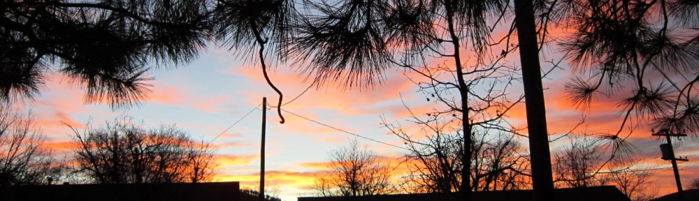
WILLIAMS — Dark clouds are blowing in on increasing winds from the east and the temperature has dropped considerably as Williams hopes for rain.

The weather forecast shows a 10% chance of rain this afternoon increasing to 30% Sunday morning in Williams. At 2 p.m. the clouds started rolling in and by 2:21 it began to rain.

Rain has been ongoing in Flagstaff which enjoys a 10% higher chance of rain through the same period. A good chance of rain is predicted for both cities Monday and Tuesday.

A hazardous weather warning was issued for thunderstorms in our area and hot, above normal temperatures for the lower elevations of the Grand Canyon. Southern Yavapai County may receive some thunderstorms and dust moving north from the Phoenix area.

Flagstaff wants residents to prepare for monsoon season

The monsoon will soon be upon us and the City’s Stormwater Management Section would like to make you aware of precautions and services provided by the City.

• Streets flood quickly! A car can float in as little as a foot of water! Do not cross flooded areas! Respect all barricades.
• If you see, or experience, a flooding emergency, please call 911.
• For non-emergency flooding concerns, please call 213-2100 or the Streets Section at 774-1605.
• Please do not leave trash cans, trash and debris in any area subject to flooding. It will float downstream and plug up stormdrains.
• If your property or home is impacted by flooding, the Stormwater Management Section will investigate the cause and may be able to help. Please contact Chris Kirkendall to report property flooding concerns at 213-2473.
• The City of Flagstaff operates a small network of radio-telemetered gauges that transmit rainfall and streamflow information in real-time (as it occurs). If you would like to see this information for the various locations in the City, plus the rain gauges in the Schultz burn area, go to:

www.jefullerdata.com/ADWR/Flagstaff/mapfs.html

• Sandbags can be obtained for free in the parking lot east of the baseball fields at Thorpe Athletic Center. The parking lot is accessed from North Aztec St. Although there are some prepared sandbags stacked and available, unfortunately, this sandbag filling area is not manned & people will need to fill their own sandbags if there is not an immediate supply of filled bags available.

Let’s make this a safe monsoon season!

Multi-Agency Response to Injured Hiker in Sycamore Falls

640sycamore-sheriff-01FLAGSTAFF — Yesterday at 12:00 pm Coconino County Sheriff’s Office Deputies and Coconino County Search and Rescue personnel responded to the report of a rappelling accident at Sycamore Falls. According to the reporting party a 56 year old male had been struck by a falling rock and was at the bottom of the canyon. Due to the remote location, treacherous terrain and the unknown extent of injuries assistance was requested from Arizona Department of Public Safety Air Rescue who responded from Kingman, AZ, Ponderosa Fire District, and Lifeline Ambulance.

300sycamore-sheriff-02Once on scene a search and rescue team member rappelled to the patient’s location and conducted an assessment. It was determined that the patient suffered isolated injuries to his left knee and foot however he did not have any serious or life threatening injuries. At that point it was determined that a helicopter rescue was not necessary and a ground based rope rescue system was constructed to raise the patient and a rescuer to the top of the cliff so he could be transported by ambulance personnel to the Flagstaff Medical Level One Trauma Center.

This incident was an unfortunate accident however the victim was wearing the appropriate safety equipment. It is important for all outdoor recreationists to tell someone where they are going, carry the “Ten Essentials”, and use the appropriate personal protective equipment for the activities they are engaged in.

Ten Essentials

1. Water
2. Food
3. Extra warm clothing
4. Navigation equipment (map, compass, GPS)
5. Headlamp/Flashlight
6. First Aid Kit
7. Shelter Material (space blanket or large leaf bag)
8. Fire Starting Kit (use extreme caution in the dry summer months)
9. Pocket Knife or Multi-Tool
10. Whistle/Signal Mirror