Coconino NF seeks input on Mt. Elden/Dry Lake Hills project

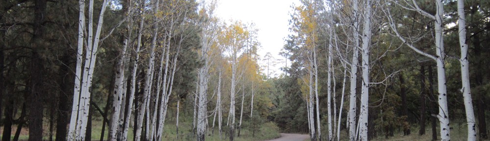
FLAGSTAFF — The Coconino National Forest is seeking public input on a proposed project to improve non-motorized trails in the Mt. Elden/ Dry Lake Hills area just outside the city of Flagstaff.

The Mt. Elden/Dry Lake Hills (MEDL) Recreation Planning Project includes proposed trail construction, relocation, re-routes, closures and improvements. It includes the construction and improvements of trailheads and will make improvements in the Mt. Elden Environmental Study Area. It also aims to identify appropriate trail systems for special-use permit events.

As the most popular and heavily used recreation area on the Flagstaff Ranger District, frequent use of the MEDL area has led to both deteriorating conditions on existing trails as well as a system of unauthorized trails.

In addition to developing a premier trail system, the MEDL project will also respond to ongoing negative impacts from unsustainable recreational uses, which affect natural resources such as wildlife, watershed and soil conditions, recreational experience, and vegetation.

The proposed plan has been modified based on comments received during last fall’s scoping period, in addition to numerous meetings with partners and stakeholders. The goal of the MEDL plan is to protect natural land and cultural resources while providing opportunities for forest visitors to enjoy public land.

The public comment period will run for 30 days, from June 1 to July 1.

An environmental analysis, as required by the National Environmental Policy Act, has been prepared and can be found on the Coconino National Forest’s website.

The Coconino National Forest will hold several informational events throughout the 30-day comment period, as listed below. Advance registration is not required.

  • 11 a.m. to 1:30 p.m. Saturday, June 5: Forest Service representatives will staff a kiosk located at “The Y” Schultz Creek Natural Area, at the intersection of Mount Elden Lookout and Schultz Pass roads
  • 8 a.m. to 10 a.m. Sunday, June 20: Forest Service staff will be available at the Flagstaff Community Market farmers market, located at City Hall, 211 W. Aspen Ave.
  • 4 p.m. to 6:30 p.m. Tuesday, June 22: Forest Service staff will be available at the Ramadas at Buffalo Park, located at 2400 N. Gemini Road

In addition, timely, project-specific written comments can be submitted online. Comments must be received by June 30 to be considered for analysis.

Only those who submit comments — as defined by 36 CFR 218.2 — will be eligible to file an objection after a draft decision notice is issued, which is anticipated to happen during the summer of 2021.

For additional information, please contact Environmental Coordinator Christine Handler at 559-920-2188 or christine.handler@usda.gov, or Recreation Staff Pat McGervey at 928-526-0866 or patrick.mcgervey@usda.gov.

Coordinated law enforcement & volunteer efforts result in cleaner forests, protection of habitat, safer off-road use

FLAGSTAFF — Memorial Day weekend was marked by efforts that resulted in a safer and cleaner Coconino National Forest, thanks to Arizona law enforcement officers, employees with state and federal agencies, along with volunteer organizations. Arizona Game and Fish Department (AZGFD), Coconino County Sheriff’s Office (CCSO), and the U.S Forest Service recently conducted several joint law enforcement efforts on the Coconino National Forest over Memorial Day weekend.

Prior to the holiday weekend, employees of these agencies and the Arizona Department of Environmental Quality, along with volunteers from National Forest Foundation, Oak Creek Watershed Council, and Friends of Northern Arizona Forests, spent several hours picking up trash at popular camping areas in the Coconino National Forest at the headwaters of Oak Creek Canyon. A 20-yard dumpster donated by Waste Management Group was filled with trash left in the forest by about 30 volunteers.

Law enforcement personnel then contacted campers as they were leaving their campsites to ensure camping areas were left as clean as when they arrived. Ten citations and 11 warnings were issued over the holiday weekend, while another 27 citations and four warnings were given last Labor Day weekend.

“This was the most thorough saturation patrol I have seen, demonstrating tremendous collaboration, planning and follow through between the Forest Service, Law Enforcement agencies and public interest groups,” said Forest Service Patrol Captain Andy Pederson. “A big thanks to Game and Fish for all the pre-work that made this event a success.”

Additionally, law enforcement agencies conducted an off-highway vehicle (OHV) patrol on the Coconino National Forest targeting unlawful off-road vehicle travel that was damaging sensitive wildlife habitat. CCSO made 144 contacts with OHVs which resulted in 25 citations, two of which were injury accidents. AZGFD made 168 contacts with OHVs, resulting in 17 citations, 11 of which were for unlawful travel off roads.

Another forest cleanup project will be conducted on June 30 in anticipation of the busy IDEPENDENCE weekend around the fourth of July. For more information about that event, see Pickin’ Up in the Pines online or send an email to sstortz@nationalforests.org.

Kaibab National Forest considers new fiber optic line to support rural communities

ASH FORK/PAULDEN — The Kaibab National Forest (KNF) is considering authorization of a new fiber optic line between Paulden and Ash Fork, Arizona. Arcadian Infracom 1, LLC has proposed the installation of a high-capacity fiber optic line to create new connectivity for Tribal and rural communities to major metropolitan areas, providing these communities with access to sufficient bandwidth to enable data intensive applications which will benefit public education, healthcare, and economic development.

The southern terminus of the fiber optic line would be located near Paulden and follow the east side of the Arizona Department of Transportation right-of-way for Highway 89 to the vicinity of the Ash Fork. Approximately 50,579 feet (9.58 miles) of the project is proposed to run through the Kaibab National Forest in the Williams Ranger District. The remainder of the line would be on the Prescott National Forest, as well as small sections of state and private lands. The total disturbance on the Kaibab National Forest would be a temporary right-of-way of 17.4 acres (15’ wide x 9.58 miles) for construction, with a permanent right-of-way totaling 11.6 acres (10’ wide x 9.58 miles).

Additional information about the project, including a map, can be found at http://bit.ly/PauldenAshforkFiberOpticPA.

Acting District Ranger Andy Kelher invites public comment about the proposed fiber optic line, and is considering use of this categorical exclusion to authorize the project on the national forest: Additional construction or reconstruction of existing telephone or utility lines in a designated corridor (36 CFR 220.6(e)(2)). If interested, please submit your written comments by June 9, 2021, by email to comments-southwestern-kaibab@usda.gov, mail to 800 South 6th Street, Williams, AZ 86046, or fax to 928-635-8208. For questions, contact Andy Kelher at andrew.kelher@usda.gov or 928-635-8230.

Stage 1 Fire Restrictions begin Friday at 8 a.m. on national forests

FLAGSTAFF/WILLIAMS/PRESCOTT — On Friday May 14, 2021 at 8 a.m. the entire Kaibab, Coconino and Prescott National Forest will enter Stage 1 campfire and smoking restrictions in an effort to protect public health by reducing the number of preventable human-caused wildfires.

Under Stage 1 restrictions, fires, campfires, charcoal, coal, and wood stoves are prohibited, except within a developed recreation site. Smoking is also prohibited, except within an enclosed vehicle, building or a developed recreation site.

Using a device that is solely fueled by pressurized liquid petroleum or LPG fuels that can be turned on and off is allowed in areas that are barren or cleared of all overhead and surrounding flammable materials within three feet of the device. Fireworks are always prohibited on all national forest lands.

Fire restrictions are implemented to help prevent unwanted, human-caused fires and to limit the exposure of visitors during periods of potentially dangerous fire conditions.

Implementation of fire restrictions normally occurs based on a combination of factors that are carefully measured. Criteria used to determine when to implement restrictions include things such as current and predicted weather, fuel moisture, fire activity levels, enduring drought, and available firefighting resources.

Additional restrictions may be applied as conditions warrant. More information about the different stages of fire restrictions can be found on line at: www.fs.usda.gov/detail/kaibab/fire/?cid=stelprd3802396

Fire restrictions typically remain in effect until the forests receive significant precipitation, at which time they will be rescinded, and the public notified.

Forest officials would also like to remind visitors that having a campfire on the national forest while under fire restrictions is a violation that can carry a mandatory appearance in federal court. Visitors should use extra caution when recreating on all public lands during fire season.

Know Before You Go! The public can obtain current state and federal fire restrictions information across Arizona on the Arizona Interagency Wildfire Prevention and Information website, and at the Coconino County website at: www.coconino.az.gov/firerestrictions

Next week’s prescribed burns include highly visible Naval Observatory project

FLAGSTAFF — Several prescribed burns – including a highly visible project located east of the Naval Observatory in Flagstaff – are scheduled to continue throughout the Coconino National Forest during the weekend and into next week.
The Naval Observatory project, which will tentatively begin on Tuesday, will likely cause large amounts of smoke visible within the City of Flagstaff.
The Upper Beaver Creek project, started in late April, is scheduled to conclude early next week.
Additionally, the Mint East project will potentially begin this weekend and run through the end of next week.
Naval Observatory:
  • When: May 11 through May 14.
  • Where: Flagstaff Ranger District. East of U.S. Naval Observatory, south of I-40. GPS: 35.184, -111.731
  • Why: To continue forest health and restoration in areas previously treated by mechanical thinning projects.
  • Size: 135 acres.
  • Duration: Four days.
  • Method/Type of Burn: Maintenance burn.
  • Smoke Impacts: With west winds predicted, smoke is predicted to move east. Units have been mechanically thinned and previously burned in. Smoke production and duration should be lighter than prescribed fire projects in untreated landscapes. Cooling temperatures in the evenings may cause smoke to settle in the low-lying areas surrounding the burn and along Naval Observatory Road and I-40 corridors. Smoke will be visible to Flagstaff Metro Area, I-17, I-40, Hwy 180, 89 and 89A corridors
  • Closures/Restrictions: None anticipated.
Upper Beaver Creek:
  • When: Monday, May 10.
  • Where: Mogollon Rim Ranger District. Approximately seven miles south of Mormon Lake. GPS: 34.780833, -111.448056
  • Why: This burn is part of a grassland restoration project that will improve forage for cattle and wildlife. It will also reduce hazardous fuels, such as dead wood and pine needles, that have accumulated in the burn area.
  • Size: 1,000 acres.
  • Duration: One to two days.
  • Method/Type of Burn: Broadcast burn.
  • Smoke Impacts: Smoke is expected to move to the northeast, so smoke impact can be expected near Lake Mary Road and surrounding homes south of Stoneman Lake Road.
  • Closures/Restrictions: None are anticipated.
  • Notes: This is the final burn planned on the Upper Beaver Creek area for this spring.
Mint East:
  • When: Scheduled to begin potentially this weekend (May 8).
  • Where: Flagstaff Ranger District. Southeast of Mormon Lake Village, FR 124, 125 and FH3 corridors. GPS: 34.907, -111.407
  • Why: To promote forest health and restoration in areas previously treated in the Camillo Fire of 2015.
  • Size: 2,554 acres.
  • Duration: Through May 14, roughly one week. This burn is divided into three separate blocks that will be completed over three to seven days, depending on weather conditions.
  • Method/Type of Burn: Broadcast maintenance burn.
  • Smoke Impacts: Smoke is predicted to move northeast. Cooler evening temperatures may cause smoke to settle in low-lying areas surrounding the burn and along the Lake Mary Road corridor. Smoke will be visible to the Flagstaff metro area, I-17, I-40, Hwy 180, 89 and 89A corridors.
  • Closures/Restrictions: None anticipated.
  • Notes: This burn aims to use aerial ignitions and burn larger acres if possible. If not, smaller blocks will be burned by hand.
Prescribed burns are always dependent upon weather and wind conditions, as well as approval from Arizona Department of Environmental Quality (ADEQ). The public can view approved prescribed burns on ADEQ’s website at smoke.azdeq.gov. Coconino National Forest burns begin with the designator “COF.”
Notifications of upcoming prescribed burns are provided regularly by news releases throughout the season and also by the following online resources:

Portions of Verde River to close starting May 10 for feral cattle removal

FLAGSTAFF — Starting May 10 and lasting through May 24, public access to portions of the Verde River will be closed to allow for feral cattle removal.
River access from Beasley Flat to the confluence with Fossil Creek will be closed and the public will not be able to launch, take out, float through or camp along this section of the river. Child Recreation Site and Verde Hot Springs will also be closed to the public.
Contractors will be capturing and removing unauthorized and/or feral cattle from the Wild and Scenic portion of the Verde River on the Coconino, Tonto and Prescott national forests. This portion of the Verde River is managed to preserve its Wild and Scenic qualities and livestock are not authorized within this corridor.
The following portion of the Verde River will be closed to the public to protect public health and safety during contracted operations to round-up and remove feral cattle.
  • As depicted on the map in Exhibit A, the Restricted Area consists of all National Forest System (NFS) lands, roads and trails within a quarter-mile of the center of the Verde River corridor, commencing north of Beasley Flat at 34° 28’ 43.68” N/111° 48’ 1.5” W, following down river and terminating at the confluence with Fossil Creek (approximately 13.5 miles) at 34° 18’ 20.534” N/111° 40’ 30.752” W. The Restricted Area includes Verde Hot Springs (34° 21’ 50.478” N/111° 42’ 55.607” W) and the Childs Developed Recreation site, including the associated boat launch/ take-out and dispersed camping area. The Restricted Area also includes the historic hydroelectric facilities and corrals.
The work includes the gathering, care, handling/loading and transportation of the cattle. The contractor will address any sick or injured animals if treatment is necessary; transport livestock from temporary holding facility at capture site to final destination within 24 hours of capture; Arizona Department of Agriculture (AZDA) Officers will inspect the captured cattle for brands and if brands are found then the AZDA will contact the owners. The capturing of livestock will be accomplished by helicopter, roping, leading or tie down when necessary. The work will be accomplished in a safe and humane manner and be in accordance with appropriate Arizona state laws and requirements.
For more information regarding this order please contact the following:
  • Red Rock Ranger District: 928-203-2900
  • Cave Creek Ranger District: 480-595-3300
  • Verde Ranger District: 928-777-2200

FEMA Updates Flood Maps in Areas of Coconino County and Flagstaff

OAKLAND, Calif. — The Federal Emergency Management Agency (FEMA) has delivered preliminary flood maps for parts of Coconino County and Flagstaff. The maps identify the revised flood hazards in Kachina Village and the Pumphouse Wash and Schoolhouse Wash drainage areas. These new maps will help building officials, contractors and homeowners make effective mitigation decisions, thereby contributing to safer and more resilient communities.

Before the new Flood Insurance Rate Maps (FIRMs) become effective, there is a 90-day appeal period from Apr. 30 to July 28. During that time, residents or businesses with supporting technical and scientific information, such as detailed hydraulic or hydrologic data, can appeal the flood risk information on the preliminary maps, which can be viewed at fema.gov/preliminaryfloodhazarddata.

Flood hazards are dynamic and change frequently for many reasons, including weather patterns, erosion, and community development. Officials from FEMA, Coconino County and the city of Flagstaff worked together to provide updated information that accurately reflects the flood risk. These changes may also affect future building standards or insurance requirements.

The local mapping project is part of a national effort led by FEMA to increase local knowledge of flood risks and support actions to address and reduce the effects of flooding on new and improved structures. FEMA encourages residents to review the preliminary flood maps to learn about local flood risks, potential future flood insurance requirements and identify any concerns or questions about the information provided.

Risk of flooding affects almost every corner of the nation. In total, 98% of counties have experienced a flood event, which makes floods the most common and widespread of all weather-related natural disasters.

New Lightning Caused Wildfire on Williams Ranger District Allowed to Burn in Natural Setting

WILLIAMS – A new lightning caused wildfire discovered earlier this week on the southeast end of the Williams Ranger District will be allowed to burn naturally within a pre-determined management area to reduce fuel loads and promote healthier landscapes.

Due to the remote location and low to moderate fire behavior observed, the Thumb Flat fire is being allowed to move naturally for the benefits of reducing hazardous fuel accumulations, increasing protection of local private inholdings, and restoring forest health. The overall strategy will be to contain the fire within a road system and various control features surrounding an area of about 475 acres.

The Thumb Flat fire is located approximately 18 miles southeast of the City of Williams near Colcord Canyon. It is currently 160 acres and is burning in a mixed fuel type that include ponderosa pine, pinon juniper, oak, and grasses. The goal is to allow the fire to burn as it would naturally as long as it can be safely managed while meeting objectives. Growth is expected to increase over the next two days with the fire spread reaching its full potential within the management area by Saturday. Forest road 12 will be burned out in order to confine the fire on the western edge.

Smoke may be visible from Williams, Prescott, and from areas around Flagstaff, but will be short in duration. No smoke impacts are anticipated to developed areas in the surrounding communities.

The Kaibab National Forest is a fire adapted ecosystem. It is dependent on fire to play a natural role in maintaining vibrant forest health. Lack of fire in the forest has caused an abundance of fuels to build up, which can make the forest vulnerable and susceptible to more dangerous uncontrollable fire incidents. Reintroducing fire back into the ecosystem is a very effective tool to reduce fuel loads and restore the landscape back to a healthier state that is more aligned with historical conditions.

During operations, fire personnel and vehicles will be visible to the public. Motorists and visitors are asked to avoid active hot areas and are reminded to use caution and drive with heightened awareness when passing through the fire vicinity.

Commercial firewood permits available for live juniper trees May 3

FLAGSTAFF — The Flagstaff Ranger District of the Coconino National Forest will begin selling commercial firewood permits beginning May 3.

Permits will cover live and dead shaggy bark juniper trees in pre-designated areas of the Yeager Canyon area located roughly 45 minutes southeast of the City of Flagstaff.

A limited number of permits are available. Permits for 10 cords each can be purchased on a first-come, first-served basis for $50 a permit ($5 per cord).

Each cutting area is between four and seven acres, ensuring 10 cords of wood will be available in each area. Specific cutting requirements and a map will be included with each permit, and more information is available by request.

Due to COVID-19, permits will be made available by mail only.

Permits can be ordered by mailing a permit request and $50 check payable to the U.S. Forest Service to the Flagstaff Ranger Station at 5057 N. Hwy 89, Flagstaff AZ 86004. The written request should include your name, address, phone number, type of identification (such as driver’s license) and identification number, make and model of all vehicles that will be working within the permit unit and the names of any additional cutters. Your written request must be signed and dated.

Firewood cutters should be aware chainsaws can throw sparks and ignite grasses and brush, so please take care when cutting firewood. Always carry a shovel and a fire extinguisher or water in case of a fire start.

Additionally, all chainsaws must be equipped with a stainless-steel spark arrestor screen. Cutters need to ensure they are aware of the current fire restrictions by checking local Forest Service information.

Unless specified elsewhere in the permit or on its accompanying map, or identified as prohibited, motorized off-road travel is authorized to access and load firewood. Please exercise caution when driving off-road and avoid resource damage.

Annual Armed Forces Day Cross-Band Test Set for May 7 – 8

NATIONAL — The US Department of Defense will host this year’s Armed Forces Day (AFD) Cross-Band Test, Friday and Saturday, May 7-8, in recognition
of Armed Forces Day on May 15. The event is open to all radio amateurs. For more than 50 years, military and amateur stations have taken part in this exercise, designed to include amateur radio and government radio operators alike.

The AFD Cross-Band Test is a unique opportunity to test two-way communications between military and amateur radio stations, as authorized under FCC Part 97 rules. These tests provide opportunities and challenges for radio operators to demonstrate individual technical skills in a tightly controlled exercise in which military stations will transmit on selected military frequencies and will announce the specific amateur radio frequencies being monitored.

The schedule of military/government stations taking part in the Armed Forces Day Cross-Band Test and information on the AFD message is available on the MARS website at, http://www.dodmars.org/home/armed-forces-day-2021.