Whiskey Fire to produce smoke southwest of Flagstaff this week

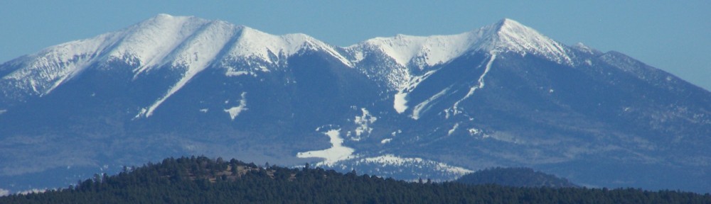
FLAGSTAFF – Wildland firefighters are managing the Whiskey Fire, a lightning-started fire reported on September 2, burning on approximately 105 acres in Ponderosa pine about 15 miles southwest of Flagstaff within the footprint of the 2014 Slide Fire.

Coconino National Forest Map

Fire managers are strategic when making decisions about how to manage a wildfire for restoration purposes.

When a wildfire begins in the forest, fire managers assess how best to use the fire as nature intended and whether or not to suppress it immediately. In the case of the Whiskey Fire, managers are using it as nature intended and allowing it to burn dense forest fuels across the landscape to help mitigate the possibility of severe wildfires in the future.

Fire managers will continue to assess the fire to determine the best course of action. Today’s operations will be similar to the last few days, where fire personnel continue to reinforce containment lines and monitor the fire for a change in fire behavior. Recent rains continue to aid fire personnel by creating excellent conditions for allowing the fire to burn slowly, consuming the forest debris at low intensities.

As temperatures drop in the evening, smoke impacts are possible to the communities of the Village of Oak Creek, Sedona, and surrounding areas. Smoke may also settle along the state Route 89A corridor. The greatest impacts will be during the early morning hours from midnight to 3 a.m. and should improve by mid-morning.

Forest users are advised to use caution when entering the proposed fire area. Firefighting vehicles and firefighters are present on roadways and smoke may reduce visibility. Parts of Forest Road 231 may be closed periodically to allow for firefighting equipment and operations. Please reduce speed and remain alert.

The Whiskey Fire will be active for weeks to come. Due to safety concerns for the public and firefighters, campers should not set up long-term campsites near the fire area.

Crews Busy with Two New Fire Starts on the North Kaibab Ranger District

FREDONIA — Two new wildfires started yesterday on the North Kaibab Ranger District of the Kaibab National Forest. Multiple interagency resources, including aircraft, responded to the incidents and took immediate suppression actions to stop the fires’ spread.

The Le Fevre Fire, located approximately 15 miles southeast of Fredonia off Highway 89A near the Le Fevre Overlook, was caused by a motor vehicle accident. Due to hot, dry and windy conditions the fire grew to approximately 20 acres in the pinyon, juniper and brush. Although the fire’s spread has been stopped, fire managers only list the containment at 80 percent due to the potential for spot fires with another day of gusty southwest winds predicted. Today, crews will continue to hold, secure and mop up the fire.

Highway 89A remains open to motorists but may be restricted to one lane to allow fire crews to utilize equipment and personnel to secure the fire. Visitors traveling in the area should use caution and be aware that fire crews and equipment may be working near the road.

The Cougar Fire was also discovered yesterday near Cougar Lake just south of the recent Castle Fire area approximately 6 miles northwest of Demotte Campground. The fire was contained at approximately one acre and was caused by lightning from a recent thunderstorm. Today fire personnel will continue to hold, secure and mop up the fire.

In addition to the two new fires, fire personnel are still closely monitoring the progress of the Ikes wildfire. This fire has been managed jointly between the Kaibab National Forest and the National Park Service since its discovery on July 25 near Swamp Point on the North Rim of Grand Canyon National Park. It is currently 7,630 acres within its 7,785 acre planning area and is being utilized in order to fulfill its natural role of reducing dense forest fuels and improving overall ecosystem health. For more information regarding the Ikes Fire please visit: https://inciweb.nwcg.gov/incident/closures/6475/

Lightning Caused Wildfire on Sitgreaves Mountain Being Monitored

WILLIAMS – A recent lightning strike on the upper third of the northeast slope of Sitgreaves Mountain is showing a plume of smoke and is visible from the communities of Spring Valley, Bellemont, and Parks. The “Rock Fire” is just over half an acre in size and is burning within the Eagle Rock Fire burn scar of 2010. The fire is located in steep terrain and has been receiving intermittent moisture since it was discovered on Sunday September 1.

Due to its location, Kaibab National Forest Managers have decided to avoid exposing firefighters to the difficult topography and high volume of snags in the area. This incident will be monitored from road systems around the base of the mountain and periodically by aircraft. There is no danger or threat to private property or residences. Firefighters will be on scene daily to observe behavior and plan for future actions as the fire moves naturally on the terrain.

Weather forecasts are predicting more isolated thunderstorms over the area for the week ahead which may influence fire behavior and visibility.

Additional information about the Rock fire will become available as the situation develops.

Information about other fires and the Kaibab National Forest can be obtained through the following sources:

· InciWeb https://inciweb.nwcg.gov/
· Twitter: www.twitter.com/KaibabNF
· Kaibab Facebook: www.facebook.com/KaibabNF

Kaibab National Forest to offer firewood permits in Navajo and Hopi communities

TUSAYAN — The Kaibab National Forest will offer free-use, paid personal-use and ceremonial firewood permits for the Tusayan Ranger District at a variety of locations in Navajo and Hopi communities over the next two months. These opportunities are part of the Kaibab National Forest’s ongoing effort to increase access to firewood for tribal members and communities.

Kaibab National Forest representatives will offer firewood permits on the specified days and times and at the following locations:

  • Friday, Sept. 13 – 8 a.m. to 2 p.m. DST – Tuba City, Flea Market
  • Saturday, Sept. 28 – 8 a.m. to 2 p.m. DST – Cameron, Cameron Celebration
  • Friday, Oct. 4 – 8 a.m. to 2 p.m. MST – Kykotsmovi Village, Honahnie Building
  • Friday, Oct. 18 – 8 a.m. to 2 p.m. DST – Tuba City, Flea Market
  • Saturday, Oct. 26 – 8 a.m. to 2 p.m. DST – Cameron, Chapter House

A permit must be acquired by anyone harvesting firewood on the Kaibab National Forest. The 2019 firewood season runs from May 1 to December 31 for the Tusayan Ranger District.

Each person, with proper identification, may obtain permits for up to 30 cords per season of combined paid-use and free-use firewood. Individuals may purchase up to two 10-cord paid-use firewood permits at a rate of $2 per cord, and may obtain one 10-cord free-use firewood permit. Ceremonial-use permits are also available, which authorize collection of two cords per individual.

The Kaibab National Forest has increased the amount of wood available to each person for purchase while reducing the cost per cord by crediting firewood cutting for the contribution it provides to forest restoration goals. By removing dead and down as well as small-diameter trees, firewood cutting can help improve forest health and reduce the risk of unnaturally severe wildfire.

It is important that a permit be acquired even for free-use areas because by tracking public demand for the various kinds of permits, the amount of wood removed, and other factors, forest managers are better able to plan for the future needs of firewood collectors and provide greater opportunities for accessing these important resources. Firewood from the Kaibab National Forest is frequently used by local community and tribal members for home heating, cooking and other critical purposes.

All firewood permits issued by the Kaibab National Forest will include a map and detailed cutting regulations as well as load tags, which must be physically attached to each ¼ cord of firewood and visible from the rear of the vehicle. The goal of this load tagging system is to ensure accountability for the amount of wood removed from the forest and to inform planning for future firewood cutting areas to meet public need and forest restoration objectives.

The removal of firewood is permitted only from National Forest lands on the specific district for which the permit is issued. Firewood cutters are reminded to take note of property boundaries and cut only on National Forest lands.

Detailed firewood cutting information and maps are available on the Kaibab National Forest website at http://bit.ly/KNFfuelwood.

Kaibab National Forest information is also available through the following sources:

  • Kaibab National Forest Website: www.fs.usda.gov/kaibab
  • Twitter: www.twitter.com/KaibabNF
  • Facebook: www.facebook.com/KaibabNF

Eden Fire allowed to burn near Clints Well

CLINTS WELL, – A lightning-caused wildfire about 4 miles northeast of Clints Well that began last week is currently being used to clean up forest fuels and burn across the landscape for restoration efforts.

The Eden Fire was reported by the Hutch Mountain lookout just after noon on August 29 and is currently 375 acres, producing light to moderate smoke.

Coconino National Forest Map

Because of low humidity and low fuel moisture, the fire has continued to burn actively since its discovery. The fire was being monitored for several days before determining it would be allowed to burn and remove hazardous fuels left from years of previous fires and debris buildup.
The fuel buildup is currently burning on steep slopes in the Lost Eden Tank area in Ponderosa Pine and grass understory within heavy dead and down trees, as well as standing dead trees. Firefighters have used burnout operations for the last several days to establish fire control lines away from the main fire. These standoff tactics are used to maximize successful restoration and minimize the risk to firefighters and public.

Today, firefighters plan to continue reinforcing and constructing control lines where necessary, as well as conduct burnout operations throughout the next several operational periods.

Large amounts of smoke will be in the area over the next few weeks,as the fire continues to consume pockets of previously unburned forest fuels well within the established 19,885 acres fire boundary.

Firefighters, along with various resource specialists, will continue to evaluate risks to property and implement appropriate suppression measures.

The public should use caution when recreating or hunting near the fire area due to hazardous fire-weakened trees, burning stump holes and fire personnel working in the area.

Updates about the Eden Fire can be found on Inciweb. Follow the Coconino National Forest’s social media sites, such as Twitter and Facebook, to get timely updates on this fire, other incidents, and forest-wide activities.

Lava River Cave closed Friday, Saturday

FLAGSTAFF – Flagstaff Ranger District is closing the Lava River Cave Friday and Saturday September 6 and 7 to use several pieces of heavy equipment at the location as it continues an improvement construction project approximately 15 miles northwest of Flagstaff.

The entrance to Lava River Cave. The short, steep descent into the cave is rocky. A short distance past the entrance the cave is completely dark. Lava River Cave, 14 miles northwest of Flagstaff, Arizona, is a mile-long lava tube cave was formed roughly 700,000 years ago by molten rock that erupted from a volcanic vent in nearby Hart Prairie. The top, sides and bottom of the flow cooled and solidified first, after which the insides of the lava river continued to flow emptying out the present cave. – Photo by Brady Smith, August 19, 2015. Credit: U.S. Forest Service, Coconino National Forest.

The improvement work is part of a larger effort to provide better visitor services to meet the demand at this popular destination. The project includes parking improvements, vault toilet installation, new trail access and installation of new informational kiosks. Other site closures may be necessary in the future to facilitate the work, but the cave will open Sunday, September 8.

For questions on this project, please call Patrick McGervey at (928) 527-3234.

4th graders get free admission to Coconino NF fee areas for a year

SEDONA — The Every Kid Outdoors annual pass provides fourth grade students, along with their families, friends and classmates, free access to Coconino National Forest fee areas, along with more than 2,000 other federal recreation areas for a year.

The Every Kid Outdoors Program encourages fourth graders to explore, learn, and recreate in spectacular settings, including national forests, parks, wildlife refuges, and marine sanctuaries.

“There are wonderful recreation and educational opportunities in the Red Rock area near Sedona to explore,” said Amy Tinderholt, Red Rock district ranger. “Visits during school trips or family vacations to experience the beauty and history in Red Rock country will provide lifelong memories.”
To obtain the free pass, fourth grade students should visit the Every Kid Outdoors website, participate in a short educational activity, and download a voucher. The voucher is valid for multiple uses between Sept. 1, 2019 and Aug. 31, 2020 to correspond to the traditional school year. The voucher may be exchanged for a plastic keepsake pass at participating federal lands offices including the Flagstaff Ranger Station and Supervisor’s Office in Flagstaff, Mogollon Rim Ranger Station near Clints Well, and Red Rock Ranger Station/Visitor Center in Sedona.

The voucher or pass grants free entry for fourth graders, all children under 16 in the group and up to three accompanying adults (or an entire car for drive-in parks) to most federally managed lands and waters. The pass does not cover expanded amenity fees such as camping or boat rides.

The great outdoors make a great classroom. Fourth grade educators are encouraged to take advantage of the wide range of educational programs and tools associated with the Every Kid Outdoors program. Educational activities, field trip options, information and tools in English and Spanish, and the ability to print vouchers for passes for students are all available on the website.

“The Red Rock Ranger District has over 300 miles of trails, access to wilderness areas, water recreation and archaeological wonders to visit—all free with your Every Kid Outdoors pass,” said Tinderholt. “Come adventure here for an afternoon, or a week, and return often!”

The Every Kid Outdoors Program was established by Congress in 2019. It replaces the Every Kid in a Park Program which was launched in 2015. It is an inter-agency collaboration between the National Park Service, U.S. Fish and Wildlife Service, Bureau of Reclamation, Bureau of Land Management, U.S. Army Corps of Engineers, National Oceanic and Atmospheric Administration, and U.S. Forest Service.

Red Rock Ranger District fee-free day on Monday

SEDONA — Coconino National Forest’s Red Rock Ranger District will be waiving amenity fees on Monday, September 2 for Labor Day.

The fee waiver includes all areas that require the Red Rock Pass, which provides access to the Palatki and Honanki Ruins, the V Bar B Cultural Site, and nearly 300 miles of multiple-use trails.

This does not include Call of the Canyon (West Fork Trailhead), Crescent Moon Ranch (Red Rock Crossing), Grasshopper Point, campgrounds or state parks.

The district offers many fee-free days throughout the year, including New Year’s Day, Martin Luther King Jr. Day, Presidents’ Day, Memorial Day, National Get Outdoors Day, Independence Day, Labor Day, National Public Lands Day, Veteran’s Day and Thanksgiving Day. Fees are waived only on the days listed, generally for day-use areas, such as picnic grounds, developed trailheads and destination visitor centers.

For more information concerning fee-free days and events on the Red Rock Ranger District visitors center, please call 928-203-2900.

New ranger selected for Red Rock Ranger District

Amy Tinderholt – Coconino National Forest Photo

SEDONA — The Coconino National Forest Supervisor has selected a new ranger for the Red Rock Ranger District after Nicole Branton moved earlier this month to serve as the deputy forest supervisor on the Mt. Baker-Snoqualmie National Forest in Washington.

Amy Tinderholt was selected as the permanent ranger for the district and comes from Deschutes National Forest in Bend, Oregon, where she left her position as the deputy district ranger of the Bend-Fort Rock Ranger District.

“We’re very excited to welcome Amy to northern Arizona,” said Coconino National Forest Supervisor Laura Jo West. “She will be a tremendous asset to the Red Rock Ranger District and brings with her a wealth of experience, positive outlook, and a fresh perspective of the issues in such a busy district.”

Tinderholt is a graduate from the University of Arizona and earned a Bachelor of Science degree in Natural Resource Management. She is a seasoned leader, specializing in recreation endeavors and partnerships, and experienced in firefighting.

“I am excited about returning to the southwest and hiking in our beautiful landscapes,” said Tinderholt. “The Red Rock Ranger District is an exciting place to be, and I’m grateful for the opportunity to serve as its ranger.”

The District is comprised of approximately 487,000 acres and encompasses the Sedona area and its colorful collection of buttes, pinnacles, mesas and canyons surrounding the red rock vistas. Over the years, the district has served as the setting of many western novels, movies, paintings, photographs and other works of art.

Fatality at Wahweap Marina near Page Arizona

PAGE – National Park Service (NPS) Dispatch at Glen Canyon National Recreation Area received a call from 911 at approximately7:58 p.m. on Sunday, August 18 and dispatched rangers to the Lake Powell Resort’s main marina in the Wahweap District of the park, near Page, Arizona. It was reported a male had jumped in the water near slip F-3and had not resurfaced.

NPS Rangers arrived on scene and the victim appeared to be ensnarled in wires and cables at a depth of 20 to 30 feet. Due to safety concerns recovery was suspended until daylight hours today.

The Glen Canyon National Recreation Area Dive Team recovered the victim at 10:53 a.m. at a depth of 249 feet. Jacob Jessop, a 31-year-old male from Colorado City, Arizona was pronounced deceased at the scene by the Coconino County Medical Examiner and transported to the Medical Examiner’s Office in Flagstaff for an autopsy. Assisting were NPS Rangers,the Glen Canyon National Recreation Area Dive Team and Coconino County Sheriff’s Office.

The incident is under investigation by the National Park Service, Coconino County Sheriff’s Office, and the Coconino County Medical Examiner. Visitors are reminded about the dangers of swimming in marinas which has led to that activity being prohibited.