Bert fire burning out

WILLIAMS — For Immediate Release. The Bert Fire on the Williams Ranger District of the Kaibab National Forest has decreased in activity over the last few days and is expected to continue to decline as the fire reaches pre-defined action perimeters.

Smoke an fire have diminished after the fire consumed the fuels of the approximately 5983 acres. Crews have effectively allowed fire to move across the landscape using techniques that were designed to successfully achieve management objectives. Much of the fire perimeter has now reached the identified boundaries previously set forth and managers are very pleased with the results.

Bert Fire experiences largest day of growth

800-bert-160620-1046WILLIAMS — As expected, the Bert Fire on the Williams Ranger District of the Kaibab National Forest reached its largest day of growth yesterday with just over 700 acres of fire spread bringing the total burned area to 5445 acres.

The Bert Fire is located ten-miles southeast of Valle on highway 180 near Ebert Mountain.

The Northern Arizona Type 3 incident management team assumed management on Tuesday morning after a predicted increase in fire activity. Crews were ready for the change in fire behavior as near record high temperatures combined with low relative humidity prompted the anticipated growth. Containment lines held while several land management objectives continued to be met with positive results including key improvements to grassland restoration.

An increase in high lifting smoke was visible from far reaching areas surrounding the vicinity of the fire but overnight impacts remained minimal. Smoke may continue to be noticeable over the next several days until monsoonal precipitation eventually arrives.

Wildcat Fire 70% contained

FREDONIA — The final report on the lightning-caused, 1,502-acre Wildcat Fire on the North Kaibab Ranger District of the Kaibab National Forest is 70 percent contained, with no additional fire growth anticipated.

The fire started June 13 south of Highway 89A in the vicinity of the Saddle Mountain Wilderness. A crew of 238 personnel have been monitoring the fire with a goal of full suppression. On Sunday, excessive temperatures caused two fire fighters to be treated for heat-realated illnesses.

There has been no growth on the Wildcat Fire for several days. Crews have successfully mopped up 100 feet in from the fire edge along 70 percent of the fire. In the wilderness, hand crews have extinguished hot spots while implementing Minimal Impact Suppression Tactics. Infrared photography shows little heat, and no spot fires have been found across the fire’s edge in days. Responsibility for management of the Wildcat Fire passed from Southwest Area Incident Management Team 4 back to the Kaibab National Forest this morning. A smaller fire organization will patrol and mop up the fire until it is 100 percent contained.

As a reminder, both the North and South Canyon trails are temporarily closed in order to provide for public and firefighter safety. Public notifications will be released once the closure is rescinded. The North Canyon Trail closure starts at Forest Road 631 and extends to the intersection of the Arizona Trail on the west side, approximately three-quarters of a mile from FR 611. The South Canyon Trail closure starts at FR 211 and extends to the west side trailhead near the junction of FR 610 and FR 2599.

Fee-Free Weekend: Independence Day, July 2-4, 2016

FLAGSTAFF — The Red Rock Ranger District of the Coconino National Forest will waive fees associated with many recreation sites and amenities July 2-4, 2016 in honor of Independence Day.

As part of this event, fees will be waived for all Red Rock Pass Fee Program sites including Palatki, Honanki, V Bar V cultural sites, and multiple trailheads.

Campgrounds and recreation sites managed by concessionaires are not included in this event. These sites include Grasshopper Point, Crescent Moon Ranch, and Call of the Canyon.

See full details and the complete list of 2016 Fee-Free Days on the Coconino National Forest.

Registration required: No
Sponsor url: 2016 fee-free days

Sponsor Contact: Red Rock Ranger District
Phone: 928-203-2900

Mount Elden will have 27 acres of forest hand-thinned

fseprd505663
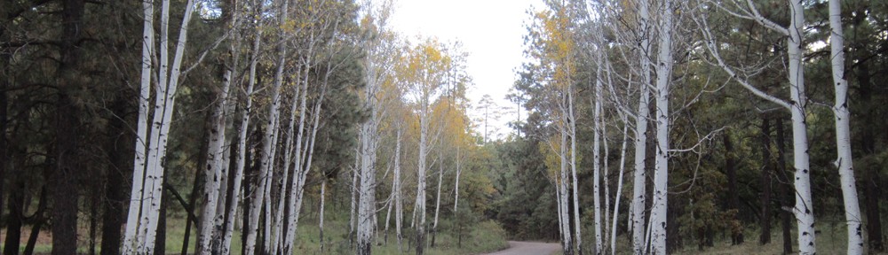
FLAGSTAFF — As part of the Flagstaff Water Protection Project, Coconino National Forest crews will begin hand-thinning 27 acres of forest around Mount Elden Wednesday (June 15) near the Rocky Ridge Trail for the next two months.

The thinning operations will be off of the Mount Elden Lookout Road (Forest Road 557), with the majority of the unit being north and west of the trail causing very little impact to users of Rocky Ridge Trail. The work crews will place signs on the trail on each end stating “tree work ahead” when necessary.

Forest Service personnel will be parking along Mount Elden Lookout road near the Rocky Ridge trail head, so forest goers should be cautious of the firefighters working in the area over the next two months.

Visit the Flagstaff Watershed Protection Project for more information about the important work being done to protect Flagstaff area watersheds and communities.

Developed recreation sites on Coconino NF exempt from fire restrictions

FLAGSTAFF — Certain developed recreation sites on the Coconino National Forest are exempt from fire restrictions, which began June 15, 2016 at 8 a.m. across the forest.

Under the restrictions, campfires, charcoal, coal and wood stoves are not allowed throughout the forest—unless in a developed recreation site.  However, fires are never advised anywhere during a Red Flag Warning such as was issued today by the National Weather Service.

The following list includes the only developed recreation sites on the Coconino National Forest exempt from fire restrictions. Note that campfires, and charcoal, coal and wood fires are prohibited at Forest Service rental cabins during Stage I and Stage II fire restrictions.

On the Flagstaff Ranger District (listed in alphabetical order):

  • Ashurst Lake Campground
  • Bonito Campground
  • Canyon Vista Campground
  • Dairy Springs Campground
  • Double Springs Campground
  • Forked Pine Campground
  • Flagstaff Nordic Center Lodge
  • Lake View Campground
  • Locket Meadow Campground
  • Narrows Picnic Area
  • O’leary Group Campground
  • Pine Grove Campground
  • Upper Lake Mary Boating Site

On the Red Rock Ranger District (which includes Oak Creek Canyon):

  • Banjo Bill Day-Use Site
  • Beaver Creek Day-Use Site
  • Bootlegger Day-Use Site
  • Cave Springs Campground
  • Chavez Group Site Campground
  • Clear Creek Campground
  • Crescent Moon Ranch Day-Use Site
  • Encinoso Day-Use Site
  • Grasshopper Point Day-Use Site
  • Halfway Day-Use Site
  • Lawrence Crossing Campground
  • Manzanita Campground
  • Pine Flats Campground

On the Mogollon Rim Ranger District:

  • Blue Ridge Campground
  • Clints Well Campground
  • Moqui Group Site Campground
  • Rock Crossing Campground

USFWS withdraws draft Recreational Boating Compatibility Determination for Havasu Wildlife Refuge, citing need for further deliberation

usfwsLAKE HAVASU CITY — The U.S. Fish and Wildlife Service (USFWS) has withdrawn its draft Havasu National Wildlife Refuge Recreational Boating Compatibility Determination (CD) for further consideration and deliberation.

According to a June 16 USFWS news release, the Service received and reviewed a substantial number of comments during the formal comment period seeking reconsideration of the draft CD. Sen. John McCain and Rep. Paul Gosar requested the draft be withdrawn.

“After reflecting on input we received at public meetings and the great numbers of letters and comments submitted, I have reached the conclusion that more communication is needed before any additional changes are introduced at Havasu National Wildlife Refuge,” said Dr. Benjamin Tuggle, USFWS southwest regional director, in the news release. “I have decided to withdraw the current draft CD at this time to allow for further discussions with the community and other stakeholders.”

“We’re appreciative that Director Tuggle changed course and that the USFWS recognized the need for a more robust public comment and community engagement process regarding this important issue,” said Kurt R. Davis, chairman of the Arizona Game and Fish Commission. “A much broader base of public input than originally was sought is vital in determining the best plan to protect the local economy, recreational opportunity and wildlife conservation.”

The USFWS news release stated that a Memorandum of Understanding (MOU) will provide the framework for ongoing dialogue with the community and interested parties. A representative from the Service’s Southwest Regional Office will lead the coordination effort with city officials and other vested parties and develop possible collaborative measures that ensure natural resource conservation is managed consistently with compatible recreational uses. This coordination will provide the foundation for the Service to develop a revised draft CD to share with the public.

Bert fire in Valle increases in size

VALLE — The Bert Fire on the Williams Ranger District of the Kaibab National Forest is showing a substantial increase in activity and is expected to grow considerably while warmer weather continues over northern Arizona. The lightning-caused Bert fire was discovered May 28 and it was decided to manage the fire to burn fuels and return the land to grass land.

The fire is approximately 3850-acres and burning ten-miles southeast of Valle on highway 180 near Ebert Mountain.

With the steady increase in temperatures and lower relative humidity over the area, fire officials are anticipating an increase in fire activity over the next few days. The current weather pattern is expected to be short term, however, with a chance of moisture predicted to return by the middle of next week. Fire behavior and smoke impacts will likely diminish as cooler weather arrives.

An increase in smoke production is expected and will be noticeable from interstate 40, Highways 180 and 64 and from several adjacent communities including Valle, Tusayan, Williams, Flagstaff, Parks, Spring Valley and Cameron. Smoke may impact these communities periodically depending on shifting wind direction and changing weather patterns. Predominant southwest winds are expected to transport smoke away from adjacent residential areas however some smoke may occasionally drift over the Coconino rim to the northeast.

Wildcat fire grows considerably

FREDONIA — The lightning-caused Wildcat Fire discovered Monday became more active this afternoon and rapidly grew to an estimated 2,000-acres on the North Kaibab Ranger District of the Kaibab National Forest. Yesterday it was at 72-acres and 50% contained.

The fire is located South of Highway 89A and southwest of the Forest Road 8910 and 211 junction within the vicinity of the South Canyon trailhead in Saddle Mountain Wilderness. The fire is currently burning in a northeast direction from the House Rock Buffalo Ranch.

The fire is currently burning in a wilderness area and there are no reports of danger to structures or evacuations.

Firefighters respond to Wildcat Fire in Saddle Mountain Wilderness

FREDONIA — North Zone firefighters on the North Kaibab Ranger District of the Kaibab National Forest are currently responding to a new fire start called the Wildcat Fire, which was discovered earlier today. They intend to suppress the fire which is about 20-acres.

The fire is south of Highway 89A and southwest of the Forest Road 8910 and 211 junction within the vicinity of the South Canyon trailhead in Saddle Mountain Wilderness. Visitors can expect to see smoke as the wildfire is highly visible from Highway 89A.

The Wildcat Fire is primarily wind driven and currently moving north-northeast. The cause of the fire is currently unknown.