Williams Ranger District Begins Elk / Lee Prescribed Fire Project

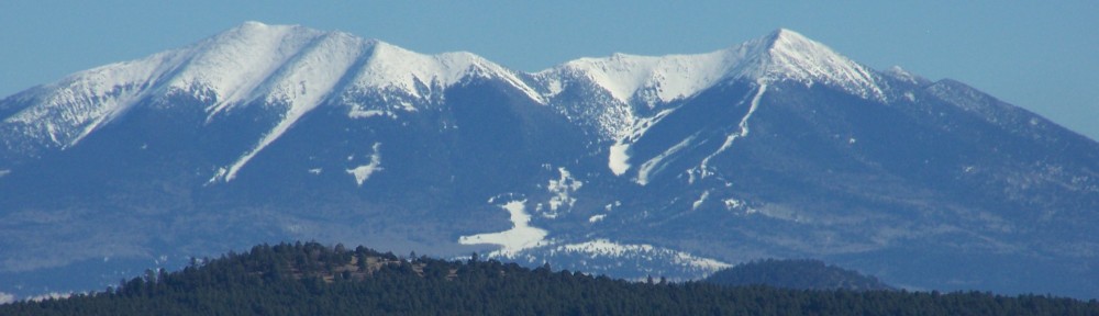
WILLIAMS — A new prescribed fire project is set to begin next week on the Williams Ranger District and will likely progress into the months ahead as opportunities arise to use fire for beneficial restoration treatments on this piece of the Kaibab National Forest. The Elk Lee Prescribed Fire project is located about 10 miles southeast of the City of Williams and is 8166 acres in size.

The project will be broken up into smaller units for daily operations to minimize heavy smoke impacts and allow ventilation to move smoke out of the vicinity more rapidly. The specific units to be ignited will be chosen based on fuel moistures and weather conditions that are within prescriptive levels that meet fuels reduction objectives. A Helicopter will be utilized to conduct aerial Ignitions which will accelerate the overall length of time the project will last, and will also reduce the number of days smoke may linger in the atmosphere.Officials understand that impacts to air quality may be unpleasant at times, however they can significantly reduce the amount and limit the duration of smoke more effectively using prescribed methods as opposed to an uncontrolled wildfire situation. To learn more about smoke and public health, visit bit.ly/SmokeHealthAwareness.

The Kaibab National Forest is part of a fire-dependent ecosystem. Fire on the landscape is critical to overall ecosystem functioning and the sustainability of local communities, watersheds and wildlife habitat. Managers use prescribed fire as a practical means to reduce risks associated with uncharacteristic wildfires that can pose significant threats to public health and safety.

During operations, fire personnel and vehicles will be visible to the public. Motorists are reminded to slow down and drive with heightened caution when passing through active project areas. Hunters and campers are encouraged to seek alternative campsites away from the active fire vicinity while operations are occurring.

All prescribed burning on the Kaibab National Forest is subject to approval by the Arizona Department of Environmental Quality. (ADEQ) To view approved prescribed burns for any given day on the Arizona Department of Environmental Quality’s website go to: smoke.azdeq.gov/

Notifications of upcoming prescribed fire projects are provided regularly by news releases throughout the year and through the following sources:

• InciWeb: inciweb.nwcg.gov/incident/5922/
• Kaibab National Forest Website: www.fs.usda.gov/kaibab
• Twitter: www.twitter.com/KaibabNF
• Facebook: www.facebook.com/KaibabNF
• Fire Information Recorded Hotline: (928) 635-8311

Quail outlook: All signs point to better season in 2019-20

PHOENIX — Truth be told, Arizona’s quail hunters are also weather wonks — always checking the forecasts, particularly during the winter months, their fingers crossed that the wet stuff is on the way.

After all, good doses of timely precipitation that time of year are what give the state’s Gambel’s and scaled quail populations a much-needed boost, which usually points to better hunting in the fall.Case in point: Winter 2018.

“Unlike the past few years, when hatch dates were spread out over the spring and summer, strong winter precipitation patterns this last winter should have concentrated hatch dates for quail clutches,” said Johnathan O’Dell, small game biologist for the Arizona Game and Fish Department.

“More quail chicks on the ground at the same time usually correlates to better overall brood survival and more birds in coveys in the fall. Spring call counts around the state were up 125 percent from the 10-year average, so Gambel’s numbers and harvest should be better than last year’s numbers.”

Translation: Expect to find a few more birds to chase when the 2019-20 season opens Friday, October 18.

While there will be a few hot spots out there, O’Dell said hunters should prepare to put in the work to find them.

“Anecdotal reports from hunters in recent years suggest that quail numbers and coveys vary by location, so it would be worthwhile to do some scouting,” he said. “Even with one good year of production — and hopefully more to come — statewide numbers will expectedly be lower than historical numbers, but hunting Gambel’s this fall should still be exciting.”

Meanwhile, hunters should note that the season for Mearns’ quail doesn’t begin until December 6. It’s summer rainfall that plays a key role in nesting success and population numbers of this species. After a spotty and relatively weak monsoon across southern Arizona, these birds are likely to be abundant only in pockets that received sufficient precipitation this summer.

A valid Arizona hunting or combination hunt and fish license is required for all hunters 10 and older. Those hunters under 10 must either have a valid hunting or combination hunt and fish license, or be accompanied by an adult who possesses a valid hunting or combination hunt and fish license. Licenses can be purchased online or at license dealers statewide. A youth combination hunt and fish license (ages 10 to 17) is $5.

The general bag limit is 15 quail per day in the aggregate, of which no more than eight may be Mearns’ quail (when the Mearns’ season opens December 6). The general possession limit is 45 quail in the aggregate after opening day, of which no more than 15 Gambel’s, scaled or California quail in the aggregate may be taken in any one day. After the opening of the Mearns’ season, the 45-quail possession limit may include 24 Mearns’ quail, of which no more than eight may be taken in any one day.

Arizona Game and Fish meeting in Flagstaff October 19 highlights hunt recommendation process

FLAGSTAFF — Those wishing to discuss all things game management, including hunt recommendations, are invited to join Arizona Game and Fish Department staff at Bull Basin Archery of Flagstaff on Saturday, October 19.

“This meeting is a great opportunity to hear from our constituents about all topics related to our game management practices and how they pertain to upcoming elk, pronghorn and wild turkey hunting recommendations,” AZGFD Flagstaff Regional Supervisor Scott Poppenberger said. “We work hard to conserve and protect more than 800 species and part of that responsibility includes a science-based hunt recommendation process designed to ensure sustainable populations of wildlife are around for future generations.”

The event is open to the public and runs from noon to 3 p.m. Saturday, October 19.
Input and recommendations are later presented to the Arizona Game and Fish Commission, which has final approval for all hunting regulation changes.

To learn more about how AZGFD works to conserve and protect the state’s wildlife or information about upcoming Arizona Game and Fish Commission meetings, visit www.azgfd.gov. To provide a contribution to support the department’s on-the-ground conservation efforts, visit www.azwildlifehero.com.

AZGF National Bison Day viewing November 2

FLAGSTAFF — Bison are synonymous with the great west, but not many people realize that Arizona is home to these magnificent animals.

To increase awareness and provide information about this great animal, the Arizona Game and Fish Department will host a bison viewing workshop near Flagstaff on National Bison Day, Saturday, November 2. The workshop will take place at the Arizona Game and Fish Commission-owned Raymond Wildlife Area (RWA) 30 miles east of Flagstaff. Sessions will begin at 9 a.m. and 10:30 a.m. and are limited to 20 people each. Both include a presentation, field trip and a light lunch.

Register for the 9 a.m. session
Register for the 10:30 a.m. session

Each session costs $40 and the deadline to register is November 1. Participants will receive the same information, presentation, field trip, with lunch including bison burgers or brats and sides.

The viewing workshop is recommended for those 12 years or older.

All fees support the Department’s Watchable Wildlife Program, which was created to increase public awareness of wildlife through positive and personal wildlife viewing experiences.

Raymond Wildlife Area is approximately 30 miles east of Flagstaff on I-40. To reach Raymond Wildlife Area, take I-40 east from Flagstaff and take exit 225. Turn right after exiting the freeway. Go 10 miles south on Buffalo Range Road to the visitor’s center. Visitors should be aware the last 10 miles is along a relatively unmaintained dirt road but accessible for passenger vehicles.

Raymond Wildlife Area was purchased by the department in 1942 from Flagstaff physician R.O. Raymond to serve as winter range for the Anderson Mesa pronghorn antelope herd. Due to drought conditions in 1945, the area became home for bison that were moved from the House Rock Valley herd.

Some scopes will be available, but it is recommended that participants bring binoculars, water, snacks, and dress appropriately for the weather and field trip. More details on the field trip will be provided during the presentations.

Flagstaff drivers should plan for overnight closure of McConnell Drive under Interstate 17 Sunday

The Arizona Department of Transportation advises Flagstaff drivers who use McConnell Drive to plan for a full overnight road closure while crews continue work to replace the McConnell Bridge on Interstate 17 and State Route 89A approaching Flagstaff.

McConnell Drive under I-17 will be closed in both directions from 8 p.m. Sunday, October 20, to 6 a.m. Monday, October 21.

Motorists should follow signed detour routes and plan for travel delays.

The project involves a full bridge deck replacement, bridge widening and sidewalk construction on the north side of McConnell Drive. Work is scheduled in three phases over two years with completion scheduled for fall 2020.

Outfitters, guides invited to apply for commercial services on Flagstaff Ranger District

FLAGSTAFF — The Flagstaff Ranger District of the Coconino National Forest is soliciting proposals from prospective outfitter and guide companies interested in providing commercial services to the public from October to December 6.

Opportunities to provide commercial services include mountain biking, day hiking, trail running, rock climbing and more. The various services are limited and are only available in the Mount Elden and Dry Lakes Area as described in the prospectus.

Proposals for additional use on existing special-use permits, as well as a limited number of new permits, will be considered. A Forest Service panel will select applicants through a competitive process based on written applications.

Applicants are advised to read the prospectus and appendices carefully. All items listed under Application Package Requirements must be complete and included for submission.

Applications submitted in response to this prospectus are subject to Cost Recovery pursuant to 36 CFR 251.58(c)(3)(iii) and will be collected through an application fee.

Applications must be received by close of business (4:30 p.m.) Dec. 6. The final decision on issuance of a special use permit will be contingent on compliance with any needed environmental analysis as determined by the National Environmental Policy Act.

The prospectus and supporting documents are available on the Coconino National Forest website. Paper copies will be made available upon request.

For questions related to this potential business opportunity, please contact Kevin Lehto at kevin.lehto@usda.gov or 928-527-8287.

Museum Fire closure area to be reduced today

FLAGSTAFF — The Coconino National Forest is reducing the size of the area closure for the Museum Fire on today to allow for increased access and recreation on parts of Mt. Elden.

The Burned Area Emergency Response team has completed treatments to the land, including mulching with a helicopter in effort to stabilize the watershed and encourage recovery. Now that this important work is complete, the public will be allowed in additional areas of the burned area.

Although additional areas are open, the public is urged to use caution, as hazards still exist such as ash pits, rolling rocks, weakened trees, falling trees and possible floodwaters.

Some areas will remain closed that pose a continued and increased risk to visitors. These areas will be re-evaluated after the winter season to see what risks can be mitigated before opening to the public.

Portions of Forest Road 789 and FR 6353 marking the restricted-area boundary are OPEN to non-motorized use only. Elden Lookout Road (FR 557) is closed to all traffic where it intersects with the Arizona National Scenic Trail. Please see the official closure order and map for details.

The following trails will be OPEN:

  • Arizona National Scenic Trail (ANST)
  • Heart Trail
  • Little Bear Trail
  • Little Gnarly
  • Lower Oldham Trail from Buffalo Park to the ANST junction
  • Rocky Ridge Trail from ANST to Schultz Creek Trail
  • Schultz Loop Trail
  • Sunset Trail from the intersection of Schultz Tank to Little Bear Trail

The following trails will remain CLOSED:

  • Brookbank Trail (entire trail)
  • Lower Oldham, from ANST to Brookbank Trail
  • Rocky Ridge Trail, from ANST to Brookbank Trail
  • Sunset Trail, from Little Bear Trail to Elden Lookout Trail
  • Upper Oldham Trail (entire trail)

For more information about the Mt. Elden area, please call the Flagstaff Ranger District at 928-526-0866.

Fire crews make progress on completion of Ikes Fire control lines

GRAND CANYON – Since the wind event that occurred last weekend, fire managers have been implementing a plan to stop the growth of the 11,000-acre Ikes Fire, which is located on the North Rim of Grand Canyon National Park and the North Kaibab Ranger District of the Kaibab National Forest.

Fire crews have been completing burnout operations over the last week along Forest Road 271 from the Grand Canyon rim to the junction of Forest Road 206. On Monday, crews began extending these operations along forest roads 206 and 4008, which connected the burnout preparation work to a point on the main portion of the Ikes Fire that burned earlier in the summer. This additional work involved about 2 miles of fire line burnout, which crews successfully completed yesterday.

In addition to the work along forest roads, the Flaming Gorge Fire Use Module began treating the area along the rim of the Grand Canyon with a burnout process that will prevent any further movement of the wildfire from the plateau area into the canyon. It will also make the area on the plateau resistant to any fire movement up and out of the canyon. Firing operations may continue into the weekend, which could result in smoke impacts similar to those that have occurred over the last two days. Smoke impacts will moderate as soon as burnout operations are completed.

The Ikes Fire remains at about 11,000 acres in size. Acreage totals may increase as burnout operations are completed over the next few days. In addition to hand ignitions, fire managers may use a helicopter to conduct aerial ignitions.

An expanded area closure is in effect on the North Kaibab Ranger District of the Kaibab National Forest in order to ensure public and firefighter safety during ongoing fire operations. The closure includes the Rainbow Rim Trail area and the viewpoints from Parissawampitts Point to Stina Point. Crazy Jug Point north of Parissawampitts is open. The Kaibab National Forest will reopen the area as soon as conditions are safe for public entry.

For hikers and mountain bikers, the Arizona National Scenic Trail is an alternative recreational opportunity while the Rainbow Rim Trail is closed. The Arizona National Scenic Trail is accessible from many points along Highway 67 and offers a variety of scenery, including views into the Grand Canyon.

Highway 67 and the North Rim Village, North Rim Lodge and businesses are open. However, some road and trail closures are in effect for the Ikes Fire area within Grand Canyon National Park. The following roads and trails are closed on the North Rim:

  • Powell Plateau Trail
  • North Bass Trail
  • Fire Point
  • Swamp Point
  • W4 road north of the intersection of the W4 and W1 roads

Smoke from the Ikes Fire has been more visible over the last few days due to the burnout operations. Visitors traveling to the area should be aware of possible smoke along Highway 67. Visitors are asked to drive carefully and turn headlights on for safety. For local air quality and related information, please visit the following websites: www.airnow.gov or the Smoke Management Division of the Arizona Department of Environmental Quality at https://azdeq.gov/SmokeManagemet.

More information can be found on InciWeb at https://inciweb.nwcg.gov/incident/6475/. Visit www.nps.gov/grca/learn/management/firemanagement.htm for additional information about wildland fire at Grand Canyon National Park.

For information about the Kaibab National Forest, visit www.fs.usda.gov/kaibab or @KaibabNF on Facebook and Twitter.

Three Sisters Prescribed Fire Project Near Williams to Begin This Week

WILLIAMS — Kaibab National Forest fire managers will begin implementing prescribed fire treatments on the first units of the Three Sisters Prescribed Fire Project near Williams beginning Friday of this week. The project is expected to take multiple days to complete, however ignitions will only occur on days that will be most effect for meeting objectives and minimizing smoke impacts to the adjacent rural areas.The 7400 acre prescribed burn area is located just north of the City of Williams and Interstate 40, east of Forest Road 124, and west of Airport Road and Highway 64. Goals of the prescribed fire treatment include decreasing the threat of unnatural severe wildfire by reducing accumulated fuels, improving forest health, and reintroducing fire to the landscape that aligns with the desired historical condition.

The project will be broken into smaller units that will be scheduled to be burned on days that will help to allow smoke to disperse away from developed areas and ventilate quicker reducing the impacts to local communities.

Area residents can expect to see and hear a helicopter in the area, as aerial ignitions will occur on portions of the burn. Smoke will be highly visible from the City of Williams and from roadways and recreation areas in the general vicinity of this project. Specific areas from which smoke is likely to be noticeable include H.A. Clark Memorial Field airport, Kaibab Lake, portions of State Route 64, Valle, the City of Williams, and Interstate 40.

Smoke is expected to lift during the day and travel northeast toward Red Lake Valley. However, cooler overnight temperatures may cause smoke to settle into low-lying areas surrounding the burn location.

Fire managers are aware that community members may be sensitive to the smoke produced, and they make every effort to limit the amount and duration of production. Prescribed fires with short-term impacts to air quality can help prevent future severe unplanned wildfires under unpredictable conditions with smoke that may pose significant risks to public health and safety.

To learn more about smoke and public health, visit bit.ly/SmokeHealthAwareness.

No road or trail closures are planned as part of the Three Sisters prescribed fire project. However, during operations, fire personnel and vehicles will be visible to the public. Motorists are reminded to slow down and drive with heightened awareness when passing through active project areas.

The Kaibab National Forest is part of a fire-dependent ecosystem. Fire on the landscape is critical to overall ecosystem functioning and the sustainability of local communities, watersheds and wildlife habitat.

Prescribed burns are always dependent on weather and wind conditions, as well as approval from the Arizona Department of Environmental Quality. Members of the public may view approved prescribed burns for any given day on the Arizona Department of Environmental Quality’s website at smoke.azdeq.gov/

Notifications of upcoming prescribed fire projects are provided regularly by news releases throughout the year and through the following sources:

• InciWeb: inciweb.nwcg.gov/incident/5922/
• Kaibab National Forest Website: www.fs.usda.gov/kaibab
• Twitter: www.twitter.com/KaibabNF
• Facebook: www.facebook.com/KaibabNF
• Fire Information Recorded Hotline: (928) 635-8311

Bald eagle breeding areas expand, number of nestlings dips in 2019

PHOENIX — A record number of bald eagle breeding areas couldn’t guarantee another shattered record of eagle nestlings, which dipped to 71 during the 2019 breeding season from 87 hatched in 2018.

A juvenile bald eagle flies away after being released at Horeshoe Lake in June 2019.

During the Arizona Game and Fish Department annual bald eagle survey this summer, raptor biologists counted a minimum of 74 occupied breeding areas statewide, which was up from the 69 counted last year. Despite that, the number of eggs laid this year dipped slightly to 97 from the 102 counted last year. 
Additionally, the number of birds that made the important milestone of their first flight, known as fledging, dipped to 63 from the 70 recorded in 2018. 

“While we always hope for Arizona’s bald eagle population to increase, it’s not uncommon for productivity to slow occasionally,” said Kenneth Jacobson, AZGFD bald eagle management coordinator. “Similar comparatively lower productivity rates were seen in 2014 and 2010, so we were due for a slow year. Overall, our eagle population continues to be strong because we continue to see an increase in breeding areas statewide. Our ongoing efforts to help conserve and protect Arizona’s bald eagles appear to be working.” 

Arizona’s bald eagle population has flourished since 1978, when 11 pairs were counted within the state and the species was listed as endangered. Today there are an estimated 74 adult breeding pairs. 

Bald eagles nationwide were removed as a protected species under the federal Endangered Species Act in 2007, but protections under the act were reinstated in 2008 in Arizona and remained until 2011. The department’s conservation efforts contributed to the species recovery.

Nationally, the birds remain protected by the Bald and Golden Eagle Protection Act.  The impressive recovery of the population is attributed to the continued efforts of the Southwestern Bald Eagle Management Committee – a coalition of AZGFD and 27 other government agencies, private organizations and Native American tribes – and its years of cooperative conservation efforts, including extensive monitoring by the nationally-awarded Bald Eagle Nestwatch Program.

The breeding season for bald eagles in Arizona runs from December through June, although eagle pairs at higher elevations nest later than those in the rest of the state.  Continued support from the committee, State Wildlife Grants, the Heritage Fund (Arizona Lottery ticket sales) and funding through the Pittman-Robertson Act, will help ensure that Arizona’s bald eagles continue to thrive.

For more information on bald eagles in Arizona, visit www.azgfd.gov (click on “wildlife”) or www.swbemc.org