Beautiful morning, but more rain on the way

Clouds hover over Bill Williams Mountain this morning.

WILLIAMS – It was a beautiful morning, but showers are expected later today and tonight. After a short break Friday, showers are expected to pick up Saturday and run through next Tuesday according to the long-range forecast.

Showers are 60% likely today and 70% tonight. Thursday there is a 30% chance of thundershowers turning partly cloudy overnight. Friday will be sunny with a high near 66 with light winds.

Saturday the rain returns with a 40% chance of showers and thunderstorms after 11 a.m. The chance increases to 60% over Saturday night and over Sunday. Sunday night, the chance drops to 40% overnight. Columbus day is Monday with government offices closing and the chance of rain dropping to 20% through Tuesday during the day.

Winds will be around 11-mph today and tonight increasing to 15-mph Thursday with gusts as high as 23-mph expected. Winds die down to about 10-mph Thursday night.

There are no hazardous or unusual weather conditions in the forecast.

You asked for it. You’re gonna get it.

FILE PHOTO

The monsoons are about to hit with a fury over the next week. There are no official weather advisories for the period, but there is a 60% chance of thunderstorms through tomorrow. Thunderstorms, of course, bring lightning so there is a possibility of fire starts. The moisture, however, might make them easier to contend with.

Tuesday through Friday the chance of thunderstorms continues ranging from 40% to 50% chance. There is a 30% chance on Saturday.

Temperatures are expected to cool slightly dropping from the low 80s to the upper 70s and there are no excessive winds predicted for the period. The forecast for Flagstaff is almost identical to Williams with slightly cooler temperatures overnight.

Rain in the future

In case you forgot, rain looks something like this.

WILLIAMS — According to the long-range forecast, moisture may move into the area next Friday. Williams and Flagstaff have a 20-percent chance of rain starting Friday morning and continuing through Saturday night. The chance of rain increases to 30-percent Sunday morning.

Whether or not it will be enough to break the drought remains to be seen.

Would you believe snow Thursday and Friday?

WILLIAMS – After a RED FLAG warning in effect from 11 a.m. to 11 p.m. tonight, winds should die down Tuesday and Wednesday. Winds will be around 14-mph with gusts up to 21-mph. Temperature should be 52-degrees Tuesday and rise to 61 Wednesday.

On Thursday there will be a 30% chance of showers after 5 p.m. with a temperature of 57. Overnight a 30 % snow with some thunder is possible with a low of 31-degrees. On Friday, a chance of snow showers before noon, then a slight chance of rain and snow showers between noon and 1pm, then a slight chance of rain showers after 1pm. Some thunder is also possible. Mostly sunny, with a high near 54. Chance of precipitation is 30%.

Friday night the precipitation should clear with a low around 33. The sun will come out over the weekend with temperatures in the 60s.

With snow forecast, don’t get blindsided on highways

PHOENIX – With snow forecast Friday in Arizona’s high country, please don’t take lightly the power and unpredictability of a winter storm as well as the potential for it to leave you stranded on a highway.

Arizona Department of Transportation snowplows will be out in force, but driving conditions are hazardous during winter weather. A highway can close suddenly if enough snow falls in a brief period or if there are crashes, slide-offs or both. That happened during Monday’s snowstorm, when northbound I-17 climbing out of the Verde Valley closed for several hours due to a serious crash.

The safest decision when snow falls is delaying travel until the storm passes and highways have been cleared. In addition to the obvious danger if your vehicle and others are stuck on or along a snow-covered highway, stranded vehicles also make clearing the roadway much more difficult and time-consuming for ADOT’s snowplows.

Before deciding whether and when to travel, check weather reports and get the latest highway conditions by visiting ADOT’s Arizona Traveler Information site at az511.gov, calling 511 or reviewing ADOT’s Twitter feed (@ArizonaDOT). When a freeway closure or other major traffic event occurs, our free app available at ADOTAlerts.com will send critical information directly to app users in affected areas – where possible, in advance of alternate routes.

If delaying travel isn’t possible, leave prepared for the possibility that you’ll spend extended time in winter conditions. Pack an emergency kit with items like extra blankets, warm clothes, food and water, cat litter or sand for traction, a first-aid kit and a fully charged cellphone.

Those looking to head up north this weekend to play in snow should remember that highway shoulders are for emergencies only. In addition to endangering you and your passengers, parking on a highway shoulder to play in the snow can distract other drivers and interfere with first responders who may need to use the shoulder.

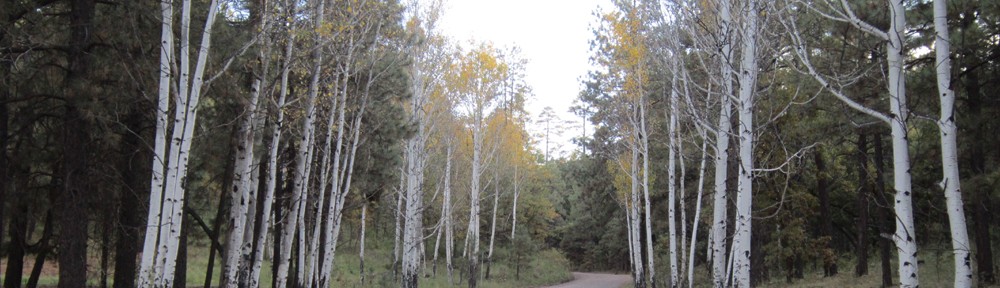
Those heading to popular snow-play areas should be prepared to spend significant time on the road, as traffic at day’s end is often heavy on highways including US 180 northwest of Flagstaff. Locations of designated snow-play areas around Flagstaff are available at flagstaffarizona.org/winter or by calling 1-844-256-SNOW.

Slow down and drive for the conditions you’re in. Be sure to leave extra room between your vehicle and the vehicle in front of you.

Give snowplows plenty of room to work. Avoid passing a plow until the driver pulls aside to let traffic by.

Winter weather advisory for tonight through Friday night

WILLIAMS – A thin sheet of ice across Santa Fe dam reservoir and other area lakes show the effects of the winter temperatures Williams has experienced the last few days. Aftera winter of spring-like weather, temperatures have dropped and snow has moved in.

Tonight snow showers are likely after 11 p.m. with a low of 21 overnight. Winds of 16 to 20-mph are expected with gusts as high as 36. 1 to 2-inches of snow are possible.

Snow will continue Friday with a hight near 29. Winds of 11 to 16-mph could gust as high as 32. Chance of 1 to 3 inches of snow over Friday. The chance of snow before 11 p.m. with a new snow accumulation of a half-inch possible. The low is expected to be around 9-degrees, but a northwest wind of 6 to 9-mph may create a wind chill factor of -2.

Saturday the weather turns sunny, with a high near 34. North wind 5 to 10 mph becoming west in the afternoon. Sun is expected to reign until Monday night when the chance of snow begins to rise again.

Flagstaff can expect slightly higher winds and a couple more inches of snow.

Winter storm coming through

WILLIAMS – Please be careful and slow down on the highways and freeways the next couple of days. High winds will likely affect high-profile vehicles and snow and rain will cause the roads to become icy overnight. Watch for snow plows on the highways and keep clear of them.

We are currently in a high wind advisory through Monday night. Today the winds are expected to reach 23-mph with gusts up to 41. On Washington’s Birthday, winds could reach 30-mph with gusts up to 48-mph. Winds will calm over Tuesday.

Rain and snow is expected to start tonight with less than an inch of accumulation. Snow will continue Monday with up to 3-inches possible. Another inch may be possible over Monday night.

Wednesday should be clear with a high near 36. Thursday is mostly sunny with a high near 40. Snow may come back in Thursday through Friday night.

High wind advisory until 7 p.m.

WILLIAMS – There is a high wind advisory for the area with sustained winds of 20 to 20-mph with gusts up to 45. The high winds may cause difficulty in driving especially with high profile vehicles. The National Weather Service recommends you consider tying down loose lawn furniture or items that may blow around. The high winds will continue until 7 p.m. tonight.

The winds should remain calm through Sunday and pick up on Monday when snow is expected to blow in. The chance of snow continues through Tuesday during the day and dropping Tuesday night. Wednesday night a chance of showers begins and runs through Friday, according to the long-range forecast.

Temperatures will remain around 50 during the period.

Monsoon rain hits hard

WILLIAMS – The monsoon rain today hit hard flooding the streets and sending tourists scurrying for cover. The rain started about 2:15 and by 2:30 p.m. the streets were flowing. Many drivers seemed to forget about turning their lights on. The rain lightened up a bit in about 20 minutes, but continued to fall by 3:10 p.m. Lightning continued through the period and there is no telling when it will let up. This is the hardest rain this monsoon season so far. Residents and visitors should take care to watch out for flash flooding.
The chance for thunderstorms remains at 50% through Tuesday during the day, mainly after 11 p.m. It drops to 30% overnight. Lightning and flash floods are, of course, the main hazards during this period.

Summer to start off with hottest day of the year

WILLIAMS – The first day of summer may turn out to be the hottest day of the year with the temperature expected to be 96-degrees. You may be able to cool off by going to Flagstaff which expects a temperature of 95-degrees. The Weather Service has issued a heat advisory through Thursday evening when temperatures will start to drop off. Light winds are expected through Thursday.

With temperatures on the rise, we caution people about keeping animals in cars even with windows slightly open. Police are allowed to break windows if they feel that dogs are in danger.

Mosquitoes have started to make their presence known, as well. Make sure you stock up on your favorite mosquito repellent. Make sure you empty outdoor water sources, such as tires, birdbaths etc., to reduce areas where mosquitoes lay eggs.