FLAGSTAFF, Ariz., Oct. 25, 2019 — As the weather continually changes this time of year, Coconino National Forest firefighters make plans to conduct prescribed burns and also alternate plans to focus on burns at locations where weather changes may help mitigate smoke impacts.
These burns are among the prescribed burn projects planned for the Flagstaff Ranger District and the Mogollon Rim Ranger District this fall and are part of a strategy to allow fire across the landscape in order to restore forests to healthier conditions, protect watersheds and improve the safety of the communities around them.
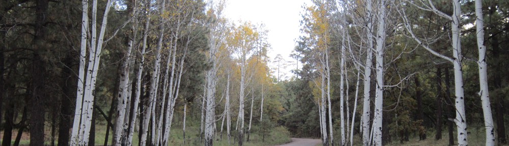
Frequent, low-intensity fire removes accumulated smaller fuels and recycles nutrients in the soils to promote healthy vegetation and wildlife habitat. A healthier forest is a safer forest for firefighters and residents when wildfires inevitably occur.
The prescribed burn projects listed below are in chronological order and may occur on days other than noted, depending on favorable weather conditions. Firing ignitions for each of these projects begin at approximately 10 a.m. on the mornings indicated.
Sawmill
- When: Likely Monday (Oct, 28).
- Where: Mogollon Rim Ranger District. Six miles south of Mormon Lake Village. North of Stoneman Lake Road on the immediate east side of Lake Mary Road. GPS: 34.8177200, -111.4269700
- Size: 800 acres.
- Duration: This is a one-day operation.
- Method/Type of Burn: Broadcast maintenance burn using drip torches. The burn is being conducted to reduce the chance of catastrophic wildfire, improve forest health, and to protect private property.
- Smoke Impacts: Daytime winds are predicted to be out of the southwest, so smoke will disperse to the northeast of the project area. Cooling temperatures in the evenings will cause smoke to settle in the low-lying areas near Hutch Mountain.
- Closures/Restrictions: None expected. If smoke is on Lake Mary Road, traffic control may be used.
Slate 4
- When: Possibly Tuesday (Oct. 29).
- Where: Flagstaff Ranger District. 16 miles north of Flagstaff. GPS: 35.446216, -111.703208.
- Size: 2,528 acres.
- Duration: One-day operation.
- Method/Type of Burn: Broadcast initial-entry burn conducted by drip torch and helicopter. This burn is located in a strategic area to protect Kendrick Park, White Horse Park and Snowbowl Estates by removing dense forest fuels that could endanger the communities if a severe wildfire started in the area.
- Smoke Impacts: Ventilation is predicted to move smoke toward the north and then switch southerly later in the day. Cooling temperatures in the evenings will cause smoke to settle in the low-lying areas surrounding the burn and White Horse Canyon. This will likely impact U.S. Highways 180, 89, Kendrick Park, White Horse Park and Snowbowl Estates. Since this is an initial-entry burn, smoke will be thicker than normal.
- Closures/Restrictions: None expected.
Victorine
- When: Planned for Tuesday and Wednesday (Oct. 29 & 30).
- Where: Mogollon Rim Ranger District. Five miles east of C.C. Cragin Reservoir along Leonard canyon GPS: 34.540840, -111.104972
- Size: 600+ acres per day (3,000 acres total).
- Duration: Four to five days (unlikely to be in the same week).
- Method/Type of Burn: Maintenance burn conducted by drip torch and helicopter to protect private lands and wildlife habitat.
- Smoke Impacts: Ventilation is predicted to move smoke toward the south. Cooling temperatures in the evenings will cause smoke to settle in the low-lying areas surrounding the burn. Smoke could impact the local community and Payson.
Upper Lake Mary 3
- When: Wednesday (Oct. 30).
- Where: Flagstaff Ranger District. Approximately 15 miles southeast of Flagstaff. GPS: 35.014971, -111.463811
- Size: 919 acres.
- Duration: This is a one-day operation.
- Method/Type of Burn: This is a initial-entry burn conducted by drip torch and helicopter. This burn’s specific objectives are to protect Pine Grove Campground and Lake Mary Road corridor from any southwesterly fire threats and to help lessen any potential wildland fires that may start near Pinegrove Campground. Since this is an initial-entry burn, smoke will be thicker and more noticeable than a maintenance burn due to the amount of forest fuels in the burn area.
- Smoke Impacts: Ventilation is predicted to move smoke toward the southwest, which may impact Lake Mary Road in the area, Interstate 17, Mormon Lake Village, and Munds Park.
- Closures/Restrictions: None expected.
89A – Block 25
- When: Wednesday (Oct. 30).
- Where: Flagstaff Ranger District. Four miles southwest of Flagstaff adjacent to Fort Tuthill county park. GPS: 35.131526, -111.697872
- Size: 421 acres.
- Duration: One day operation.
- Method/Type of burn:This is an initial-entry broadcast burn using drip torches and conducted jointly with Flagstaff Fire Department. The burn is being conducted to reduce the chance of catastrophic wildfire, improve forest health, protect private property and helping the health of the forest.
- Smoke Impacts:Ventilation is predicted to move smoke toward the southwest away from I-17. Cooling temperatures in the evenings will cause smoke to settle in the low-lying areas surrounding the burn, Pumphouse Wash and Kelly Canyon.
- Closures/Restrictions: None expected.
Experimental Forest
- When: Friday (Nov 1).
- Where: Flagstaff Ranger District. Six miles northwest of Flagstaff. GPS: 35.272710, -111.691766.
- Size: 302 acres.
- Duration: This is a one-day operation.
- Method/Type of Burn: Broadcast maintenance burn conducted by drip torch. This burn is being conducted for fire research purposes and in partnership with NAU, RMRS, and Ecological Restoration Institute in order to measure things such as pine regeneration, tree mortality, and other factors associated with wildfire in this fire-dependent ecosystem. Note: the heavy fuels will be seen burning from U.S. Highway 180 for a week or longer. They look similar to a small campfires in the middle of the forest.
- Smoke Impacts: Ventilation is predicted to move smoke toward the northeast and may impact U.S. Highways 180 and 89 north of Flagstaff. Cooling temperatures in the evenings may cause smoke to settle in the low-lying areas of Ft. Valley Ranch, Cheshire, and possibly Baderville.
- Closures/Restrictions: None expected. However, Arizona Department of Transportation (ADOT) will likely reduce the speed limit on Hwy 180 and impose lane restrictions where needed.
Notifications of upcoming prescribed burns are provided regularly by news releases throughout the season. Timely updates about ignitions and whether or not a project is cancelled can be found on the Forest’s social media sites: