Heather Provencio selected as new Kaibab National Forest Supervisor

300pxHeatherProvencioWILLIAMS — Southwestern Regional Forester Cal Joyner recently announced that the new forest supervisor of the Kaibab National Forest will be Heather Provencio, who currently serves as the deputy forest supervisor on the White River National Forest in Colorado.

“We’re excited to have Heather return to the Southwestern Region. She has a people-centered view of the environment that I believe is the proper focus for finding a creative balance that meets the needs of the forest, the surrounding communities and tribes, as well as employees,” Joyner said. “Heather’s strong grounding in northern Arizona will allow her to quickly gather momentum and move ahead on implementing the new Kaibab Forest Plan, Four Forest Restoration Initiative and fire management programs.”

Provencio is no stranger to northern Arizona and its landscape, people, challenges and opportunities, having worked in various jobs on the Coconino National Forest adjacent to the Kaibab from 2001 until 2013, including as the district ranger for the Red Rock Ranger District headquartered in Sedona, Ariz.

“I am excited by the idea of getting back to northern Arizona, which I consider home,” Provencio said. “I am also excited by the challenges that I know await me on the Kaibab and the learning and professional growth that those will bring. I am very much looking forward to being part of and leading a cohesive and exceptional team of employees who take on difficult issues and still find time to do critically important work like connecting the public with their National Forests.”

Provencio was born and raised in southern Illinois and grew up in a Forest Service family. She moved to Arizona in 1982 to attend Northern Arizona University and pursue a bachelor’s degree in anthropology with an emphasis in archaeology. Her first job with the Forest Service was in 1985 as a firefighter on the Chevelon Ranger District of the Apache-Sitgreaves National Forests, after with she held a variety of positions in archaeology, recreation and business administration until returning to school to pursue her master’s degree in anthropology. She then held positions as an archaeologist and tribal liaison before becoming a district ranger and, subsequently, a deputy forest supervisor. Provencio is scheduled to begin her role as forest supervisor of the Kaibab National Forest Oct. 5.

“I will strive to be an excellent leader for the employees of the Kaibab and our communities and partners. They deserve nothing less, so I will continually work on improving my skills as a leader,” Provencio said. “I hope to create strong connections between our employees, the Forest Service lands we manage, and the public.”

New wildfire on Tusayan Ranger District growing due to dry conditions

TUSYAN — A lightning-caused wildfire on the Tusayan Ranger District of the Kaibab National is burning actively and growing in size due to dry weather conditions.

The 50-acre Rock Fire is located near Rock Lake Pothole just south of the Coconino Rim about 15 miles southeast of the Town of Tusayan. The wildfire, which was started by lightning July 31 and discovered by fire managers Aug. 1, is burning at a low-to-moderate level of intensity through an area dominated by ponderosa pine trees. Fire managers plan to allow the wildfire to take its natural course within predefined boundaries in order to help restore ecological balance across the landscape so that the area is more resilient to threats, such as future high-intensity wildfires.

Today firefighters will prepare for the wildfire’s anticipated future growth by lining archaeological sites, range fences, trick tanks, and any other potentially fire-sensitive resources near the fire area. This important work ensures that as the Rock Fire grows, fire managers will be able to allow it to take its natural course without the risk of negatively impacting other values in the area.

Given dry conditions in the forecast for the next few days, the Rock Fire is expected to burn actively, grow significantly in size, and produce smoke that is visible from Cameron, Tuba City, Valle and Highway 64. Smoke may sink overnight into Tappan Wash and potentially move toward Cameron and then rise and dissipate in the morning hours as temperatures increase.

Spring fire grows slowly

800-spring-2015-07-25-03
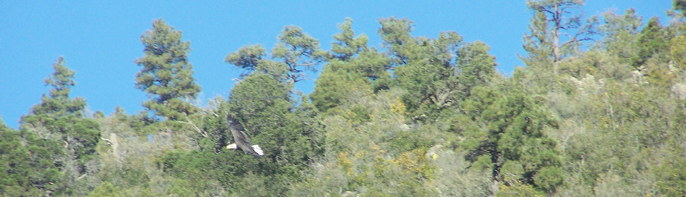
WILLIAMS — The residents of Williams, Parks, Sherwood Forest and the areas in between should receive a break from smoke over the next few days. The fire has grown almost 2700-acres, but because of the rains the progress of the Spring fire has slowed.

Today the firefighters continued work on reinforcing the perimeter road boundaries to prevent the fire from spreading beyond when the fire flares up as conditions become drier. They are also lining archaeological sites, private property and other fire-sensitive resources near the fire area.

Smoke is expected to be light and mostly visible in the area of the fire along County Road 73. Summit Mountain Trail 68 is temporarily closed due to the fire activity.

Spring fire smoke reaches Williams area

WILLIAMS — The smoke in Williams, Garland Prairie, Sherwood Forest and Parks area is originating from the 2554-acre Spring Fire centered about 9 miles south east of Williams. The fire started on July 2 and was converted to a managed fire to burn off excess fire fuels.

On Tuesday the fire could be seen burning atop Davenport Knoll. The smoke is heavy, at times, along County Road 73, also known as South Road or Perkinsville Road. At night, when the temperatures drop, the smoke travels lower to the ground and may become heavy in Williams and the surrounding area.

There is a 60% chance of thundershowers this afternoon and 30-to 40% throughout the weekend. If rains come it could cause problems for fire managers who are trying to keep the fire burning. If the storms bring mostly lightning, we could see more fires starting.

In either case, campers are reminded to take care with their campfires and make sure they are completely out when leaving. Fire managers set boundaries which they hope to keep the fire from crossing. Fires started outside those boundaries cause problems with management efforts.

Springs Fire continues to meet management objectives

Smoke from Spring fire visible from Williams, but County 73 currently unaffected.

Smoke from Spring fire visible from Williams, but County 73 currently unaffected.

WILLIAMS — The 410-acre, lightning-caused Springs Fire continues to meet fire management objectives, allowing natural fire to play its part in the ecosystem, improving both wildlife habitat and overall forest health. Crews are monitoring growth and evaluating the need for actions to keep the fire at a low to moderate intensity. The potential for continued growth depends on a variety of factors to include weather conditions, potential fuel continuity and winds.

Fire managers performed blacklining operations, yesterday, on the south side of County Road 73, also known as the “South Road” between Forest Road 354 (near Kunde Knoll) to Forest Road 3117. County Road 73 will now serve as a boundary to stop or eliminate fire growth to the north. Today blacklining may be conducted along boundaries near private lands, as the Springs Fire moves closer to sections of private land within the fire area.

Light impacts of smoke can be expected in the Garland Prairie and Sherwood Forest areas as winds are forecasted out of the southwest. Smoke may be visible in the Bellemont and I-40 area, Dogtown Lake and White Horse Lake vicinity. Over the next several days the wildfire is expected to move up Summit Mountain, where smoke may be more visible from a greater distance.

The fire, which started July 2, is located 9 miles southeast of Williams, near Davenport Knoll, to the west of Summit Mountain. No closures exist at this time, however campers are advised to be cautious when selecting campsites along Forest Road 354 and Forest Road 110. Although smoke was visible from Williams today, camp sites along County 73 are unaffected.

Bowe Bergdahl gets leave cut short when found during a pot raid.

2014-8aug-07-bowe-in-uniform-ft-sam-nbcMendocino County, CALIFORNIA — Bowe Bergdahl, the U.S. Army deserter who was traded for four terrorists, was “detained” in Mendocino County, California at a marijuana raid while on leave.

According to FOX news, the Mendocino County Sheriff’s office took Bergdahl into custody during a raid in Redwood City by the county’s Marijuana Eradication team. The team found 180 mature marijuana plants growing at the house.

It was determined that Bergdahl was not part of the operation and was released to the U.S. Army North command where he is stationed. Sheriff officials said it is not unusual to release persons who might find themselves in a situation where they did not know the plants were growing.

Army spokesperson Cynthia O. Smith confirmed to FOX news that Bergdahl was returned to his duty station at Fort Sam Houston in Texas and has not been charged with any crime involving his time on leave.

Springs Fire expected to grow despite recent precipitation

Kaibab Forest Service photo.

Kaibab Forest Service photo.

WILLIAMS — The Springs Fire on the Williams Ranger District of the Kaibab National Forest has slowly continued to grow to 240 acres, despite recent precipitation. The wildfire, which was started by lightning July 2, is located 9 miles southeast of Williams near Davenport Knoll, just west of Summit Mountain.

Fire managers continue to pursue a number of objectives, first and foremost, both the safety of the general public and firefighters on the ground. At the same time, teams are allowing natural fire to play its role in the ecosystem, enhancing wildlife habitat and improving forest health.

Recent actions to manage the fire have included: removing small trees and brush away from infrastructure such as power lines and communication sites, protecting fire-sensitive archeological sites, and range fences. Burning around perimeter roads, also known as blacklining, to limit the fire’s growth in specific directions has already occurred on sections of Forest Road 354 and future operations could potentially include County Road 73, also known as Perkinsville Road, or the “South Road,” and Forest Road 110 depending on the movement of the fire.

About 15 fire personnel are currently assigned to the Springs Fire. Resources include a fuels crew, one engine, and one dozer, all from the Williams Ranger District. Depending on future movement of the fire, additional resources could be called in to assist.

While very little smoke has been visible over the last few weeks, drier conditions in the forecast are expected to potentially increase fire activity and smoke production. Fire managers expect the fire to remain at low to moderate intensity as it moves through the forest, which should keep smoke production and impacts at relatively low levels. Due to prevailing winds, smoke will largely be pushed towards the northeast, towards Sherwood Forest and Garland Prairie vicinities. At this time there are no closures associated with the Springs Fire.

Mason Fire reaches final size of 4,370 acres

mason004aTUSYAN — The Mason Fire on the Tusayan Ranger District of the Kaibab National Forest has been contained after growing to 4,370 acres and providing multiple resource benefits since it started a few weeks ago.

The Mason Fire, located 7 miles southeast of Tusayan and 4 miles south of Grandview Lookout Tower, was one of four lightning-caused wildfires being managed as part of the Jar Complex to achieve ecological and other resource and community protection objectives. The Old Fire eventually merged with the larger Mason Fire, while the Lost and Shale fires that were located just east of Highway 64 several miles south of Tusayan never grew larger than about an acre in size each due to persistent rain showers over their locations.

“The Lost and Shale fires were in an ideal location, and we hoped they would eventually pick up in activity so that fire could move across the landscape,” said Quentin Johnson, fire management officer for the Tusayan Ranger District and incident commander for the Jar Complex. “But it was the Mason Fire that ended up having the most growth potential, and we are pleased that it reached the size it did.”

The Mason Fire burned at low-to-moderate levels of intensity over the course of its existence and had effects fire managers said were important in enhancing wildlife habitat, reducing the potential for future high-intensity fires, and improving forest health conditions.

As noted by Bruce Hill, fire lookout at Red Butte and a valued member of the Tusayan Ranger District fire organization, the Mason Fire not only met resource objectives but did so without impacting visibility at Grand Canyon National Park, an accomplishment that is not always easy to achieve given the district’s location just south of the iconic canyon.

While smoke was visible at times from Desert View, Cameron, Tusayan and highways 64 and 180, impacts were short-lived and mostly isolated to light smoke sinking into low-lying areas south of Tusayan along Highway 64 in the early morning hours on a few days.

Johnson added that he was proud that fire was able to play its natural role as a disturbance factor in the ecosystem and, that during its 22 days of spread, there were no injuries to fire fighters involved in its management.

The Mason and Old fires were both managed within a predefined 16,100-acre planning area. However, as the fires merged and then spread into sparser fuels, they naturally started dying out on their own. Then, significant precipitation associated with Hurricane Delores reached the Mason Fire over the weekend, putting it out almost entirely.

“For us, a planning area represents where we would be comfortable with and think the fire could eventually spread given the right conditions,” said Johnson. “It doesn’t mean it’s always going to get there, and that’s okay. We are allowing the fire to do what it would have naturally done historically. It would have been started by lightning during monsoon season, moved around for days or weeks, and then been put out by rain or by reaching natural landscape features. That’s exactly what happened with the Mason Fire. To me, that’s a success story.”

This New Bill Could Ban GMO Labeling for Good

Natural Society Photo

Natural Society Photo

According to the Natural Society website, this piece was rejected by Facebook. It is interesting that their “security systems” would block this. We’ll do our part to help. If this is rejected on our Facebook page, you can find the link to the full article below. Our thanks to Anthony for covering this important topic.
“Thousands of our fans, including those with March Against Monsanto, have found this post to be blocked on Facebook. Why is this being blocked? When I tried to post this article to both the Natural Society page and my Anthony Gucciardi Facebook page I was met with a warning that this post was blocked due to ‘security measures.’ Needless to say, this raised many questions. What do you think?”


640usda-monsanto-gmo-labels by Anthony Gucciardi

Want some more proof that Monsanto and other biotech giants are deathly afraid of GMO labeling initiatives passing within the United States? A new bill introduced by Monsanto’s star representative, Mike Pompeo, could soon ban all mandatory GMO labeling in the US.

The worst part? It was just approved by the House Agriculture Committee, which means it’s one step closer to becoming a full-fledged law. The bill is formally known as H.R. 1599, or the ‘Safe and Accurate Food Labeling Act of 2015.’

More precisely, it has been dubbed to be the ‘Monsanto Protection Act’ on steroids.

Read more at Natural Society

Tusayan Ranger District announces office hours for remainder of July

TUSAYAN — Due to recent changes in staffing, the Tusayan Ranger District of the Kaibab National Forest will be offering reduced office hours for the remainder of July. The office is located at 176 Lincoln Log Loop in Tusayan, just south of the South Rim entrance to Grand Canyon National Park.

“I apologize for any inconvenience these reduced hours might have on visitors to our office,” said Tusayan District Ranger James Simino. “We are working to remedy this situation as soon as possible, but we ask for the public’s patience with us in the interim.

The Tusayan Ranger District office, (928) 638-2443, will only be open from 8 a.m. to 3 p.m. on the following days for the remainder of July:

Friday, July 17
Monday, July 20
Tuesday, July 21
Wednesday, July 22
Thursday, July 23
Tuesday, July 28
Wednesday, July 29
Thursday, July 30

For passes, maps, permits, information, or any other needs on days when the Tusayan Ranger District office is closed, please call or visit one of the other Kaibab National Forest offices.

Kaibab Supervisor’s Office
Williams Ranger District
800 S. 6th St.
Williams, AZ 86046
(928) 635-8200

Williams Ranger District
742 S. Clover Rd.
Williams, AZ 86046
(928) 635-5600

Cameron Field Office
S. of Cameron Chapter House
Cameron, AZ 86020
(928) 679-2037