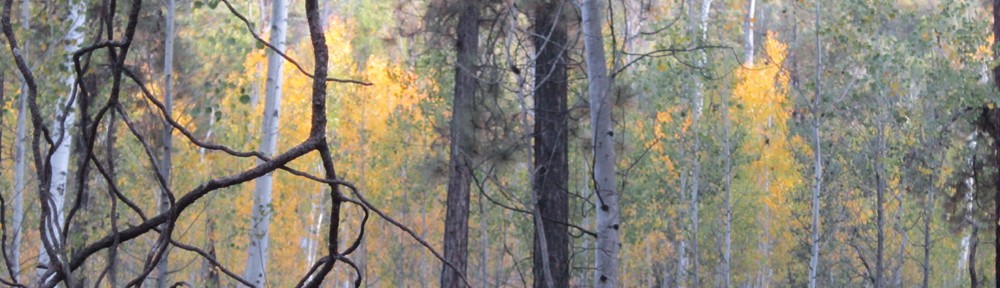
 FREDONIA — While conducting planning area prep work for the Burnt Fire, North Zone fire personnel discovered a new lightning-caused wildfire on July 9, which has been named the Corral Fire. The Corral Fire point of origin is located approximately one mile south of the Burnt Fire point of origin.
Located within the already active Burnt Fire planning area boundary, both wildland fires are being managed in an area that has previously been deemed safe for firefighters to manage. This forest type has been identified by the Kaibab National Forest Land and Resources Management Plan, also known as the Kaibab forest plan, as appropriate for management actions.
Under the Kaibab forest plan, management of naturally-caused fires enables both forest and fire managers to reduce the risk of high severity fires, improve the resiliency of the forest’s natural ecosystems in the face of climate change, and increase the quality and quantity of important wildlife habitats within the Kaibab National Forest.
“If deemed safe to manage, these lightning-caused fires can be our most effective tool to restore the landscape and to return fire to fire-adapted ecosystems,” said North Zone Fire Management Officer Ed Hiatt. “By allowing fire to perform its natural role across the landscape, we can achieve the desired conditions outlined in our forest plan – to protect our surrounding communities, infrastructure, heritage resources, and recreational settings from severe wildfires.”
Together, both fires will be managed as the Burnt Complex within the previously established 3,915-acre Burnt Fire planning area. Both the 24-acre Corral Fire and the 85-acre Burnt Fire are bound by Forest Service Road (FSR) 228 on the north, FSR 274 on the south and west, and FSR 22 on the east.
Today fire behavior is active, which means that fire is spreading on the ground through duff, litter, and other fuels. Fire managers do anticipate smoke to lightly impact driving conditions along FSR 22. Currently, there are no road or trail closures in effect; however, hazard signs are posted, and motorists are reminded to be extremely cautious when driving in the vicinity and around firefighters and working equipment.
Since the Fourth of July weekend, North Zone firefighters have responded to nine lightning-caused fires across the North Kaibab Ranger District, five of which occurred on July 8 and are listed below:
- Willis Fire – lightning caused and located just east of LeFevre Overlook. Approximately .10 acre in size. Action taken: none, currently in monitor status as it received rain several times during the day.
- Highway Fire – lightning caused and located on a northwest slope between AZ Highway 89A and FSR22. Approximately .10 acre in size. Action taken: air support responded, took suppression action, and the fire is contained.
- Lakes Fire – lightning caused and located on FSR 217, one mile in from AZ Highway 67. Approximately .10 acre in size. Action taken: suppressed, contained and controlled.
- Murrays Fire – lightning caused and located along AZ Highway 67 near mile-marker 588. Single tree burning next to road edge. Action taken: suppressed.
- Point Fire – lightning caused and located along AZ Highway 67. Two miles south of the Murrays Fire. Single tree burning near roadway. Action taken: suppressed.
Like this:
Like Loading...

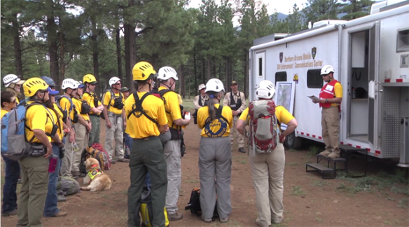 FLAGSTAFF — A new training video which was a year in the making titled “Introduction to Search Management Best Practices” has been released to aid in training search managers. The video project was a joint effort between the Coconino County Sheriff’s Office Search and Rescue Unit, a Mountain Rescue Association member team, and the National Park Service Branch of Search and Rescue. To maximize its benefit to the search and rescue community, the video is being distributed free of charge via the internet. The video is intended to be used in conjunction with a comprehensive search management course or as a review of search management concepts for seasoned search managers.
 TUSAYAN — As anticipated by fire managers, two lightning-caused wildfires being managed to improve forest health on the Tusayan Ranger District of the Kaibab National Forest merged yesterday, bringing the total number of acres treated to 2,200. The Mason and Old fires, which are part of the Jar Complex, are located about 7 miles southeast of the Town of Tusayan and 4 miles south of Grandview Lookout Tower.