Kaibab National Forest burns through next week

WILLIAMS — Fire managers with the Kaibab National Forest plan to conduct a series of prescribed burns over the weekend and continuing through next week in three locations on the Williams Ranger District in order to reduce hazardous fuels and increase ecosystem health and forest resiliency.

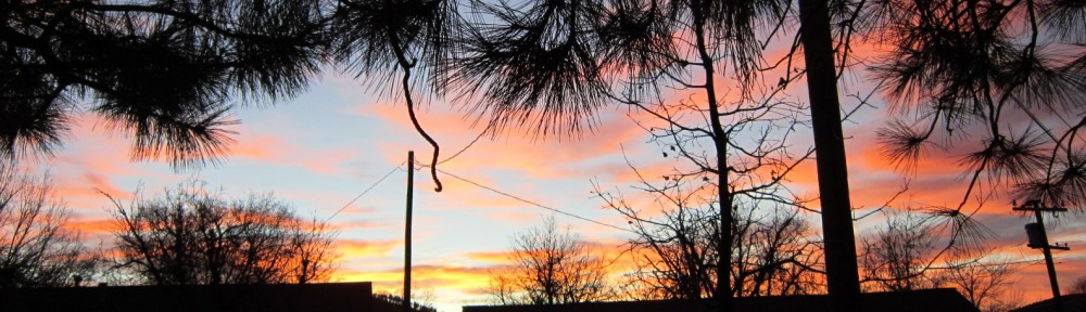
  • Dutch Kid Prescribed Fire: Over the weekend and continuing through Monday, fire managers will use aerial ignition to treat up to 4,115 acres in the Dutch Kid project area, which is located on and surrounding Dutch Kid Knoll about 7 miles south southwest of the City of Williams. Due to prevailing winds, smoke will likely be visible in Williams, the vicinity of Bill Williams Mountain, the Woods Subdivision, Interstate 40 and Parks.
  • McCracken Prescribed Fire: Weather conditions predicted for early next week may provide a window of opportunity to treat up to 2,531 acres using a combination of hand and aerial ignition techniques in the McCracken project area, which is located between Barney and Kunde knolls about 7 miles south southeast of the City of Williams. Smoke will likely be visible from County Road 71 and Williams and may also drift into Sycamore Canyon during overnight hours.
  • Kendrick Prescribed Fire: Fire managers had hoped to begin treating the Kendrick project area yesterday but had to postpone due to high winds. If weather conditions are appropriate next week, about 2,700 acres could be treated using a combination of hand and aerial ignitions techniques. The area is located west of the Kendrick Mountain Wilderness boundary about 11 miles north of the Parks community. The area has been treated with fire in the recent past, so the scheduled prescribed fire is considered a maintenance burn, which should result in less smoke production than a first-entry burn due to lesser accumulations of forest fuels. Prevailing winds should push smoke north and east across Kendrick Mountain. Smoke is expected to dissipate quickly but could be present in the vicinity of Pumpkin Center. It may also be visible from Highway 180 and from Interstate 40 near Parks.

All prescribed burning on the Kaibab National Forest is subject to approval by the Arizona Department of Environmental Quality and appropriate weather conditions. For additional information on the Smoke Management Division of the ADEQ and to view prescribed burns authorized on any given day, please visit http://www.azdeq.gov/environ/air/smoke/index.html. Kaibab National Forest fire information is also available through the following resources: InciWeb http://inciweb.nwcg.gov/incident/4112/; Kaibab National Forest Fire Information Phone Line (928) 635-8311; Text Message – text ‘follow kaibabnf’ to 40404.

Tusayan Ranger District fire managers announce locations scheduled for prescribed burning starting this fall

TUSAYAN — Fire managers for the Tusayan Ranger District of the Kaibab National Forest are announcing locations where they plan to complete prescribed fire projects starting this month and continuing through much of next year. Up to about 6,000 acres could be treated across the district during that time as long as weather and fuel conditions allow.

Areas that could be treated are as follows:

Tusayan East Prescribed Fire: East of Tusayan, approximately 260 acres
Russell Prescribed Fire: Two burn units southeast of Tusayan, approximately 1,700 acres
Flying J Prescribed Fire: Two burn units west of Tusayan, approximately 300 acres
Reed Prescribed Fire: Four burn units east of Tusayan, approximately 3,700 acres

During prescribed fires, community members and visitors may see fire personnel and vehicles in the vicinity. Smoke may also be present and may result in short-duration impacts to populated areas.

All prescribed burning on the Kaibab National Forest is subject to approval by the Arizona Department of Environmental Quality and appropriate weather conditions. For additional information on the Smoke Management Division of the ADEQ and to view prescribed burns authorized on any given day, please visit http://www.azdeq.gov/environ/air/smoke/index.html.

Prior to any given prescribed fire, additional information will be released regarding location, timing and anticipated smoke impacts. Kaibab National Forest fire information is also available through the following resources: InciWeb http://inciweb.nwcg.gov/incident/4113; Kaibab National Forest Fire Information Phone Line (928) 635-8311; Text Message – text ‘follow kaibabnf’ to 40404.

US 60 east of Superior to close briefly for blasting operations Oct. 6-8

PHOENIX — Motorists traveling along US 60 between Phoenix and Globe next week need to plan ahead or allow extra time as the Arizona Department of Transportation continues blasting work as part of an improvement project to build a new passing lane and widen roadway shoulders east of Superior, approximately 65 miles east of downtown Phoenix.

The construction of the two-mile-long climbing lane from Devil’s Canyon to Oak Flat (mileposts 231-233) will require four separate full closures of US 60 for up to 90 minutes:

  • Tuesday, Oct. 6, at 9 a.m. to 10:30 a.m.
  • Wednesday, Oct. 7, at 9 a.m. to 10:30 a.m.
  • Thursday, Oct. 8, at 9 a.m. to 10:30 a.m. and again from 1 p.m. to 2:30 p.m.

Traffic on eastbound US 60 will be stopped east of Superior (milepost 227) and westbound US 60 will be stopped at the Top of the World, west of Miami (milepost 235) until the blasting work is completed and the roadway is reopened after all debris is cleared. Law enforcement officers will be stationed at each closure to assist with traffic control.

Immediately prior to each blast, crews need to set the concrete barrier for that blast and additional delays are possible.

ADOT anticipates the highway will be closed at least once per week for blasting for up to three months. As blasting continues there will be a lesser impact on traffic and delays will be reduced.

Motorists seeking an alternate route can consider state routes 77 and 177, which is approximately 68 miles long. Motorists headed to the White Mountains region, including Show Low and Springerville, can also take State Route 87 through Payson and travel east on State Route 260 as an alternative.

ADOT will work to minimize the traffic impacts as much as possible, including scheduling some nighttime work.

There will be narrow traffic lanes, wide-load restrictions and a reduced speed limit through the work zone. Flaggers and pilot cars will be used at different times throughout the project.

Drivers are asked to use caution, watch for construction equipment and personnel, and allow extra time for your commute.

For more information on the project, please visit azdot.gov/us60oakflat.

100 Acres of Prescribed Fire planned near Jacob Lake

pb-fredonia-1FREDONIA — With a favorable window of opportunity expected to remain open on the North Kaibab Ranger District for the remainder of the week, North Zone fire managers plan to commence this year’s prescribed fire season as early as tomorrow by initiating ignitions in the Moquitch 4 project area.

The Moquitch 4 burn unit is geographically located approximately 6 miles south of Jacob Lake and is bound by Forest Service Road (FR) 217 and dozer line on the east, FR 282 on the west, FR 260 on the north and FR 212 on the south. Mainly comprised of ponderosa pine with scattered clumps of aspen and patches of New Mexico locust, this planned fuels treatment is intended to reduce hazardous fuel loads, improve wildlife habitat and stimulate aspen regeneration in the project area.

Fire managers began fuels treatments in this project area in June and to date completed 96 acres of the 1,104 acre planning area. Tomorrow, fire managers plan to target an additional 100 acres in the southern-most portion of this burn unit and continue working in a northerly direction throughout the following week until complete.

Implementation of prescribed fires is dependent on weather and fuel conditions including winds, temperature, humidity, moisture of the vegetation and ventilation conditions for dispersal of smoke, as well as, prior coordination with the Arizona Department of Environmental Quality.

Smoke may be visible from the vicinity of Jacob Lake, AZ Highway 67 and AZ Highway 89A.

“Understanding that smoke is often not a popular trade-off for having a healthy forest in a fire adapted ecosystem, part of our goal is to get the word out to people in our local communities as soon as possible and limit our operations to times when smoke has the best chance of dispersing,” said North Zone Fuels Specialist Dave Robinson.

Prior to igniting a prescribed burn, fire effects crew monitors use a pilot balloon (PIBAL) to construct a wind profile to determine wind direction and wind speed. If conditions are not appropriate to implement a prescribed fire treatment, then operations are halted until conditions fall within established parameters. In addition to conducting PIBAL operations, fire effects crew monitors also measure, monitor and document the effects of fuels treatment projects during implementation.

“The documentation generated by our fire monitors is important in determining how we can improve forest health and also in measuring our compliance with various laws, our forest plan and burn plans to help ensure the quality of our air, our water and our reforestation efforts,” said North Kaibab District Ranger Randall Walker.

Forest visitors are reminded to use caution when in the vicinity of fire personnel and fire vehicles during prescribed fire operations. Visitors should drive slowly, turn on headlights, and avoid stopping in areas where fire personnel are working.

Kaibab National Forest fire information is also available through the following resources: InciWeb http://inciweb.nwcg.gov/; Kaibab National Forest Fire Information Phone Line (928) 635-8311; Text Message – text ‘follow kaibabnf’ to 40404; Twitter www.twitter.com/KaibabNF.

One lot of “Good ‘N’ Fun – Beefhide Chicken Sticks” recalled due to possible salmonella contamination

GoodnFun-1Deerfield, FLORIDA — Salix Animal Health, LLC today announced it has initiated a voluntary recall of one lot of “Good ‘n’ Fun – Beefhide Chicken Sticks” because it may have the potential to be contaminated with Salmonella. Salmonella can affect animals eating the product and there is risk to humans from handling contaminated products.

Healthy people infected with Salmonella should monitor themselves for some, or all, of the following symptoms: nausea, vomiting, diarrhea or bloody diarrhea, abdominal cramping and fever. Rarely, Salmonella can result in more serious ailments, including arterial infections, endocarditis, arthritis, muscle pain, eye irritation, and urinary tract symptoms. Consumers exhibiting these signs after having contact with this product should contact their healthcare providers.

Pets with Salmonella infections may be lethargic and have diarrhea or bloody diarrhea, fever, and vomiting. Some pets will have only decreased appetite, fever and abdominal pain. Infected, but otherwise healthy pets can be carriers and infect other animals or humans. If your pet has consumed the recalled product and has these symptoms, please contact your veterinarian.

The recalled “Good ‘n’ Fun – Beefhide Chicken Sticks” was distributed nationwide by Salix Animal Health to Dollar General and Dollar Tree retail stores.

The recalled product is packaged in a 2.8 ounce bag stamped on the back side with lot # AO15010 and with an expiration date of 03/2018. The UPC code is 0 91093 82247 1.

No pet or consumer illnesses from this product have been reported to date. However, because of our commitment to safety and quality, Salix Animal Health is conducting a voluntary recall of this product.

The potential for contamination was noted after routine testing by the Georgia Department of Agriculture revealed the presence of Salmonella in one 2.8 ounce package of “Good ‘n’ Fun – Beefhide Chicken Sticks” labeled with the recalled code.

No other product is affected at this time. Customers should look at the lot code and expiration date on the product package to determine if it is subject to the voluntary recall. Customers who have purchased the product subject to this recall are urged to dispose of the product or return it for full refund.

We take our responsibility to pets and their owners seriously and as a result we are investigating the cause of this problem so that we can prevent it from occurring in the future. Salix Animal Health, is also working with retailers to ensure that the affected product is no longer sold and removed from inventory.

If you have these products, please contact Salix Animal Health’s consumer affairs team at 1-800-338-4896, Monday through Friday between the hours of 8:30 AM – 5:00 PM Eastern Standard Time for a refund. Customers with questions may call the consumer affairs team at the number listed above.

Hoot & Howl Your Way through Bearizona during the Howly Growly Owly Festival

Howly-7280WILLIAMS — Bearizona is hosting Howly Growly Owly Festival weekends in October. Visitors are encouraged to dress up in costume and kids that do will get a “beary” special treat!

Festivities Include:

Howl-O-Ween Express: Hop on the windowless bus that takes visitors through the drive-through animal exhibits. This is about as close as you are going to get to our animals, so you don’t want to miss out. Patrons can howl with the wolves in the Alaskan Tundra & Arctic Wolf enclosure and watch the bison interact with a special Howl-O-Ween enrichment treat. Bus rides depart from the Fort Bearizona parking lot at 12:00 p.m., 2:00 p.m. & 4:00 p.m. every Friday and 10:00 a.m., 12:00 p.m., 2:00 p.m. & 4:00 p.m. every Saturday and Sunday in October.

Growly Bear Cave: Check out our array of jack-o-lanterns that adorn the inside of the Kindergarten Bear Cave.

Scarizona at Bearizona Haunted House: Those who dare can walk through our super scary Haunted House (PG-13 Rated) open Friday 12:00p.m.-5:00p.m. Saturday ave Sunday 10:00a.m-5:00p.m.

Raptor Show: Guests should plan to catch an Owly Raptor Show at 11:00 a.m., 1:00 p.m. or 3:00 p.m., after visiting Fort Bearizona’s baby and smaller animals.

Photo Ops: Several areas of the park are decorated in different themes so visitors can take photos with their families.

Scavenger Hunts: Both adults and children can get in on this fun activity. Check in at the front of Fort Bearizona Walk Through with the attendant and get your scavenger hunt form. After you complete the scavenger hunt make sure to turn in your card at the gift shop for a prize.


Bearizona’s mission is to promote conservation through memorable and educational encounters with North American wildlife in a natural environment.

ADEQ Lifts Fish Consumption Advisory for Gila River and Tributaries

PHOENIX — The Arizona Department of Environmental Quality (ADEQ) announced today that it has lifted the consumption advisory for fish caught in the Gila River and its tributaries within and downstream of the Phoenix metropolitan area – this includes 100 miles of streams and 286 acres of lakes. Fish caught from these waters are no longer unsafe to eat due to banned pesticides (DDT, chlordane or toxaphene).

“This is the first time ADEQ has lifted a fish consumption advisory,” said ADEQ Water Quality Division Director Trevor Baggiore. “Fish tested by ADEQ and the U.S. Fish and Wildlife Service show that banned pesticides no longer pose a health risk in the Gila River and its tributaries.”

Lifting this advisory, which has been in place for 24 years, is credited to the cessation of the use of the pesticides in the 1970s, 1980s and 1990s. Detailed information about the delisting of the Gila River and its tributaries can be found at:

Click to access delisting_hassayampa.pdf

ADEQ and the U.S. Fish and Wildlife Service tested 67 fish tissue samples from eight different fish species in the Gila River and several of its tributaries west of Phoenix during 2011 and 2012. Fish tissue data demonstrated banned pesticide levels (DDT, toxaphene and chlordane) dropped from more than 160 times higher than threshold levels designed to protect human health in the 1990’s, to 16 times lower than these thresholds in 2011 and 2012.

On March 10, 2015, ADEQ requested that the U.S. Environmental Protection Agency (EPA) remove the Gila River and its tributaries from Arizona’s Impaired Waters List, which EPA approved August 7, 2015. Each water body removed from the list also had a fish consumption advisory in effect. ADEQ has lifted the fish consumption advisory for the following waterbodies:
capture_original
map_original

Resources

ADEQ Fish Consumption Advisory Fact Sheet (PDF):
https://www.azdeq.gov/environ/water/assessment/download/fca.pdf

ADEQ Water Quality Division Monitoring and Assessment:
http://www.azdeq.gov/environ/water/assessment/index.html

Arizona Game and Fish Department – Arizona Fish Consumption Advisory List: http://www.azgfd.gov/h_f/fish_consumption.shtml

Kaibab National Forest to conduct prescribed burn near Kendrick Mountain

WILLIAMS — Fire managers with the Kaibab National Forest plan to conduct a series of prescribed burns starting tomorrow and continuing through Monday near Kendrick Mountain on the Williams Ranger District in order to reduce hazardous fuels and increase ecosystem health and forest resiliency.

About 2,700 acres are scheduled to be treated to the west of the Kendrick Mountain Wilderness boundary and approximately 11 miles north of Parks, Ariz., using a combination of hand and aerial ignition techniques. The area has been treated with fire in the recent past, so the scheduled prescribed fire is considered a maintenance burn, which should result in less smoke production than a first-entry burn due to lesser accumulations of forest fuels.

Winds are predicted to be from the south southwest, which should push smoke north and east across Kendrick Mountain. Smoke is expected to dissipate quickly but could still be present in the immediate area in the vicinity of Pumpkin Center. It may also be visible from Highway 180 and from Interstate 40 near Parks, Ariz.

All prescribed burning on the Kaibab National Forest is subject to approval by the Arizona Department of Environmental Quality and appropriate weather conditions. For additional information on the Smoke Management Division of the ADEQ and to view prescribed burns authorized on any given day, please visit http://www.azdeq.gov/environ/air/smoke/index.html.

Kaibab National Forest fire information is also available through the following resources: InciWeb http://inciweb.nwcg.gov/incident/4112/; Kaibab National Forest Fire Information Phone Line (928) 635-8311; Text Message – text ‘follow kaibabnf’ to 40404.
800-kendrick-1

US 93 traffic switch planned for Thursday north of Wickenburg for widening project

PHOENIX — The Arizona Department of Transportation continues to make considerable progress on an improvement project to widen and upgrade a five-mile segment of US 93 between State Route 71 and State Route 89, just north of Wickenburg.

On Thursday, Oct. 1, crews are scheduled to switch both directions of traffic to the newly constructed southbound lanes. As crews make preparations for the planned traffic switch, motorists may be stopped intermittently for up to 15 minutes at a time between 6 a.m. and 6 p.m. on Oct. 1.

While one travel lane will remain open in both directions, motorists should continue to be prepared to allow 10 to 15 minutes extra travel time through this segment (mileposts 185-190).

Once the traffic switch is complete, ADOT will begin work to repave and restripe the existing northbound lanes.

ADOT began this expansion project in February to widen US 93 from two lanes to a modern, four-lane divided highway. The $12.5 million project is expected to be completed in November.

Once completed, ADOT will move one step closer to the agency’s ultimate goal of transforming the entire 200-mile stretch from Wickenburg to the Hoover Dam bypass bridge into a modern, four-lane divided highway.

Since 1998, ADOT has invested more than $350 million in projects to upgrade the US 93 corridor, which stretches from Kingman to the Nevada state line and Wickenburg to Interstate 40 (a 23-mile segment of I-40 east of Kingman connects the north and south sections of US 93).

Currently, all but 46 miles of the 200-mile drive (more than 75 percent) from Wickenburg to the Nevada state line has been upgraded to a four-lane divided highway in an effort to improve traffic flow, support the movement of freight and enhance safety through this heavily traveled area.

Rescuers Respond to Paria Canyon Twice in Two Days

FLAGSTAFF — On Sunday, September 27, the Sheriff’s Office was made aware of a sick hiker in Paria Canyon in very close proximity to where the previously described response occurred. The DPS helicopter based in Kingman responded, located the ill hiker, and landed. The individual was flown out of the canyon and subsequently refused any medical treatment.

Yesterday at about 5:00 pm, the Coconino County Sheriff’s Office was contacted by a Kane County Utah Sheriff’s Deputy who advised of a personal locater beacon spot activation in Paria Canyon approximately 8 miles upstream from Lees Ferry. The family members of the hikers in possession of the device, indicated to investigators that the distress signal was a level 2 which indicates the individuals initiating the signal are sick or injured and need help as soon as possible.

Due to the late hour of the day, the impending darkness and the rugged terrain, an air search was conducted by the Arizona Department of Public Safety Air Rescue Helicopter based in Flagstaff—instead of a ground search. The helicopter left the airport at 5:30 pm and arrived at the location where the device was activated an hour later and began an air search.

Crew members spotted the hikers approximately 1 mile downstream from the initiation point. The pilot was able to safely land the helicopter and crew members made contact with the group of hikers. According to one of the individuals, he was changing the batteries in the spot locater and accidentally activated the level 2 emergency signal. None of the party members required transport and the DPS helicopter returned to Flagstaff.

The Coconino County Sheriff’s Office would like to thank the Arizona Department of Public Safety for the availability of air rescue helicopters and crews. This vital service is extensively utilized by the Sheriff’s Office throughout Coconino County on search and rescue assignments and a wide variety of other law enforcement related missions.