Sonoran Corridor: We want to know what you think

TUCSON – Nearly halfway through a three-year environmental study, state and federal transportation officials want your input on a proposed Sonoran Corridor connecting Interstate 10 and Interstate 19 south of Tucson International Airport.

The Arizona Department of Transportation and the Federal Highway Administration will hold a public information meeting from 5:30 to 7:30 p.m. Wednesday, September 26, to hear public comments and suggestions for the Sonoran Corridor. The meeting will be held at the Desert Diamond Casino, 7350 S. Nogales Highway in Tucson. A presentation will begin at 6 p.m.

The Sonoran Corridor has been designated as a high-priority corridor under the federal Fixing America’s Surface Transportation (FAST) Act. It would support and connect the economy of southern Arizona and the entire state. It also would reduce travel distances south of Tucson and relieve congestion at the current interchange of I-10 and I-19 southwest of downtown Tucson.State and federal officials are identifying and studying a range of possible corridors along with the opportunities and constraints of each. The study considers the potential social, economic and natural environment impacts of the alternatives, as well as the impact of not building a freeway in this area.

The Tier 1 Environmental Impact Study is a three-year process developed in accordance with the National Environmental Policy Act. Expected to be completed in 2020, the Tier 1 study is evaluating multiple 2,000-foot-wide corridor alternatives that would connect I-19 and I-10 south of the Tucson International Airport. The study will evaluate a no-build alternative and multiple build alternatives to determine a recommendation that is based on technical analysis and other factors, including public input.

A future Tier 2 environmental study would advance the Tier 1 recommendations to identify the specific project alignment, effects and mitigation. There is no timeline or funding identified for the Tier 2 study.

For more information about this study, please visit azdot.gov/SonoranCorridor.

The meetings are part of the public involvement process that allows the community the opportunity to ask questions and offer comments and concerns about potential locations for the proposed corridor as well as environmental considerations, impacts on wildlife habitat and cultural resources, and other modes of transportation that may be considered.

Public comment also is welcome through October 26 in several ways:

* Email: Sonorancorridor@azdot.gov

* Toll-free bilingual information line: 855.712.8530

* Mail: Sonoran Corridor Tier 1 EIS Study Team,m c/o Joanna Bradley, 1221 S. Second Ave., Mail Drop T100, Tucson, AZ 85713

The September 26 meeting is a follow-up to public meetings held in Tucson and Sahuarita in June 2017.

New virtual tour of South Mountain Freeway is online now

PHOENIX – As the Loop South Mountain Freeway moves toward completion in late 2019, a new flyover animation reflects updated plans for the 22-mile-long corridor.

The six-and-a-half minute virtual tour of the South Mountain Freeway, the largest single freeway project in state history, is available at SouthMountainFreeway.com.

It updates a 2013 video completed in conjunction with the publication of the Draft Environmental Impact Statement by the Arizona Department of Transportation and Federal Highway Administration, and before much of the final design work had been completed.

Some of the key design modifications and additions highlighted in the latest video include:

  • Aesthetic and landscaping treatments reflecting neighboring communities
  • Direct HOV lane access near 59th Avenue from the South Mountain Freeway to and from downtown Phoenix
  • A six-mile-long shared-used path in Ahwatukee, located south of the freeway between 40th Street and 17th Avenue
  • Changes to the alignment that reduce the amount of right-of-way required
  • Interchange reconfigurations, including diverging diamond interchanges at Desert Foothills Parkway and 17th Avenue, moving the interchange at 51st Avenue to Estrella Drive, and realigning the freeway at 59th Avenue south of Elliot Road
  • Locations of sound walls to mitigate freeway noise
  • A city of Phoenix pedestrian bridge north of Broadway Road to connect the Rio del Rey neighborhoods in Phoenix.

The updated video doesn’t reflect design changes made after January. As a design-build project, construction can start in some areas of the project while design is still being finalized elsewhere. This innovative contracting method pairs the design and construction teams to deliver a project from beginning to end. This approach is intended to save time and money by overlapping the design and construction phases.

With the launch of the new video, the project webpage at SouthMountainFreeway.com has other new content, including aesthetic renderings and construction photos.

The South Mountain Freeway will provide a long-planned direct link between the East Valley and West Valley and a much-needed alternative to Interstate 10 through downtown Phoenix as it runs east and west along Pecos Road and then north and south between 55th and 63rd avenues, connecting with I-10 on each end.

Approved by Maricopa County voters in 1985 and again in 2004 as part of a comprehensive regional transportation plan, the South Mountain Freeway will complete the Loop 202 and Loop 101 freeway system in the Valley.

No services available for part of Wednesday, January 18, at I-10 Burnt Well Rest Area

PHOENIX – Restrooms, drinking fountains and vending machines won’t be available at the Interstate 10 Burnt Well Rest Area west of Phoenix from 10 a.m. to 1 p.m. Wednesday, January 18, due to utility work in the area.

Motorists will still be able to stop at the rest area, which has locations in both directions at milepost 86 near Tonopah, while the power is out and services aren’t available.

Other ADOT rest areas along I-10 between Phoenix and the California state line are Bouse Wash at milepost 53 and Ehrenberg at milepost 4.7.

South Mountain Freeway will have Frank Lloyd Wright influences

frank-wright-cropPHOENIX — In the late 1920s, modern architect Frank Lloyd Wright arrived in Arizona to design a desert resort planned for the foothills of South Mountain, in what is now Ahwatukee.

To produce drawings for the project, Wright and his colleagues built a temporary settlement, called “Ocatillo,” near what is now 32nd Street and two-thirds of a mile north of what will be the Loop 202 South Mountain Freeway. The name intentionally misspelled ocotillo, the desert plant that grew in abundance there.

While the stock market crash of 1929 ended Wright’s project, nearly a century later his connection to the area will influence how drivers experience the South Mountain Freeway.

Working with the Frank Lloyd Wright Foundation, the Arizona Department of Transportation and its project team are honoring Wright as they design aesthetics for bridges, sound walls and other freeway elements.

“Frank Lloyd Wright had a strong presence at the base of South Mountain before Ahwatukee was even built,” said Joe Salazar, ADOT’s roadside development, project landscape and architecture coordinator. “Frank Lloyd Wright was inspired by Arizona’s desert surroundings, and the South Mountain Freeway will tell that story.”

One of the freeway’s five distinctive aesthetic character areas, between Ahwatukee Foothills and the Interstate 10/Loop 202 Santan Freeway interchange, is named for and influenced by Wright’s Ocatillo settlement. Simple materials in the patterns on architectural features in that freeway segment will celebrate that area’s desert landscape and vegetation.

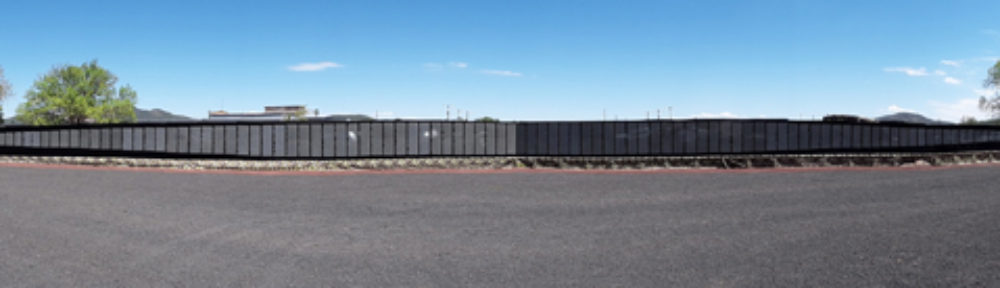
And preliminary plans for the entire freeway call for using horizontal lines, featured in many of Wright’s designs, in different ways. The wood walls of Wright’s Ocatillo settlement featured bold horizontal lines to echo the desert floor and the area’s long horizons.

The South Mountain Freeway’s sound walls and retaining walls will have horizontal lines, in contrast with the vertical lines used along other Valley freeways.

“These horizontal lines evoke a sense of motion, a perfect complement to the energy of a freeway,” said architect Victor Sidy, who is working with the Frank Lloyd Wright Foundation on the project. “As one travels through the length of the freeway, these lines will serve as a connective thread that will narrate a story of transition from the city to the natural desert and back to the city.”

Aesthetics are an essential part of any ADOT design project, creating looks that complement the surroundings, help tell an area’s story and create a more appealing environment for drivers.

In addition to Ocatillo Settlement, the South Mountain Freeway’s distinctive aesthetic character areas will be: Cholla Ocotillo between Elliott Road and east of Desert Foothills Parkway; River Bank between the Salt River Bridge and Elliot Road; Leaf Portal between Roosevelt Avenue and the Salt River Bridge; and Mountain Urban Link between the I-10 (Papago Freeway)/Loop 202 interchange and Roosevelt Avenue.

There will be five associated landscape character areas – Ahwatukee Neighborhood, Ahwatukee Foothills, Laveen Village, Estrella Village and Interstate 10 Traffic Interchange – with specific plants, color accents, ground treatments and other elements.

Together, these character areas will tell stories by highlighting land use, land forms and history. The Ahwatukee Foothills/Cholla Ocotillo segment, for example, will feature desert plants and simple shapes based on the forms of native cholla and ocotillo cactuses, while aesthetics and landscaping in the Laveen Village/River Bank segment will speak to that area’s agricultural heritage.

In early November, plans to incorporate Wright’s influences brought ADOT’s landscape and aesthetics team, along with representatives of Connect 202 Partners, the development group designing and building the South Mountain Freeway, to Taliesin West in Scottsdale. The national historic landmark, Wright’s winter home until his death in 1959, is home to the Frank Lloyd Wright Foundation and Frank Lloyd Wright School of Architecture.

With representatives of the Frank Lloyd Wright Foundation, participants refined design plans for sound walls, bridges and other structures and drew further inspiration from Wright’s work. The refinements will be reflected in a landscape architecture and aesthetics design concept report developed with input from ADOT, Federal Highway Administration, city of Phoenix and Maricopa Association of Governments, the regional transportation planning agency.

Wright’s influence will be evident in other ways. In the Mountain Urban Link character area, for example, interlocking L-shapes planned for design elements are inspired by the work of both Wright and Paolo Soleri, the renowned modern architect behind Arcosanti and Cosanti in Arizona.

ADOT’s Salazar called the South Mountain Freeway a rare opportunity to create aesthetics and landscaping for an entire freeway corridor at once rather than in stages. That opportunity also creates a challenge that requires additional thought and consideration, Salazar added.

“We are thankful for the collaboration with the Frank Lloyd Wright Foundation and others, including the Cosanti Foundation, to develop a freeway corridor that will tell stories as it enhances the quality of life in this region,” Salazar said.

The 22-mile freeway, expected to open by late 2019, will provide a long-planned direct link between the East Valley and West Valley and a much-needed alternative to I-10 through downtown Phoenix. Approved by Maricopa County voters in 1985 and again in 2004 as part of a comprehensive regional transportation plan, the South Mountain Freeway will complete the Loop 202 and Loop 101 freeway system in the Valley.

Four states sign pact to create I-10 Corridor Coalition

PHOENIX — In a move to make travel on Interstate 10 safer and more efficient, the transportation leaders in four states have created a coalition supporting innovation along the corridor.

An agreement establishing the voluntary I-10 Corridor Coalition, proposed by Arizona Department of Transportation Director John Halikowski, was signed June 2 by Halikowski and:

• Malcolm Dougherty, director of the California Department of Transportation
• Tom Church, cabinet secretary of the New Mexico Department of Transportation
• James Bass, executive director of the Texas Department of Transportation

“The efficient flow of commerce in Arizona drives our state’s economic vitality,” Halikowski said. “This agreement with our transportation partners in California, New Mexico and Texas will work to build a reliable, friction-free I-10 corridor to support Arizona’s businesses and export industries.

“We want to see the day when a truck or a non-commercial vehicle can travel the 1,700 miles between Los Angeles ports and Houston ports – safely, efficiently and without delay,” Halikowski added.

The I-10 Corridor Coalition is modeled after a coalition involving 15 states that govern Interstate 95 between Florida and Maine. For Arizona, the partnership is designed to remove what transportation officials refer to as “friction” – such as the variety of commercial vehicle permitting and inspection practices in each state along I-10 – that makes the movement of goods less efficient than it could be.

Commerce flowing on Interstate 10 across California, Arizona, New Mexico and Texas is the engine of a powerful economic region. I-10 is the primary trucking route to and from the Port of Long Beach, which connects to Asian markets, and connects the trillion-dollar markets of Southern California and central Texas.

If the four states were combined, the region would have the 10th largest economy in the world.

“Someday we want the I-10 Corridor to be filled with truck platoons and connected vehicles, weigh-in-motion sensors and automated truck parking lots,” Halikowski said, outlining a vision for the safer, more efficient movement of commercial and non-commercial traffic.

The coalition will employ the transportation expertise of the states collectively to enable resource sharing, joint testing and economies of scale, Halikowski said. It will apply best practices to improve safety and efficiency along the corridor, improve freight movement, expand and coordinate the use of technology along the corridor, and promote cooperative planning.

The coalition also will engage other levels of government and private stakeholders throughout the corridor to achieve the goals of friction-free travel.

State agencies working to reduce risk of blowing dust from farm along I-10

PHOENIX — With trucks spraying water, first responders standing by to close Interstate 10 when conditions warrant, and air quality and agriculture representatives advising the land owner, state agencies are working to reduce the risk from dust blowing off recently plowed farmland in southeastern Arizona.

The Arizona Department of Transportation and Arizona Department of Public Safety have closed 60-plus miles of I-10 several times in recent weeks as dust has severely limited visibility at milepost 376 near the New Mexico state line. That has sent traffic on a 110-mile detour from US 191 east of Willcox and from US 70 near Lordsburg, New Mexico, through Safford.

Over the weekend, ADOT began using eight tanker trucks to haul water, transferring it to two larger tankers belonging to a local contractor that are used to spray water in hopes of creating a layer of wind-resistant crust. The trucks have given an initial watering to more than 320 acres of the 640 acres responsible for most of the dust restricting visibility on the interstate.

“We’ve mobilized these forces on a short-term basis to help ensure safety and maintain mobility,” said Jesse Gutierrez, ADOT’s deputy state engineer for statewide operations.

Representatives of the Arizona Department of Environmental Quality and Arizona Department of Agriculture are working with the land owner on best practices for reducing dust.

Meanwhile, ADOT employees and Arizona State Troopers are stationed along I-10 near the field and are ready to immediately close the interstate when conditions warrant. With strong winds in the forecast for the coming weekend, more closures are a possibility even after trucks have given the field an initial watering.

“We realize that closing I-10 for an extended period is a hardship for motorists, for drivers of commercial vehicles and for those along the lengthy detour route, but in this case the safest option is the only option,” ADOT Director John Halikowski said. “ADOT and other state agencies are collaborating to improve highway safety and also limit the economic and time costs created by these dust closures.”

The agencies are keeping track of their use of state resources to reduce dust, improve highway safety and limit disruption of the I-10 corridor and will work with the land owner to arrange reimbursement. The owner is cooperating with these efforts, but the Department of Environmental Quality can require action should that change.

“ADEQ continues to work diligently with the other state agencies and the cooperating farmer to find meaningful short- and long-term solutions to the dust issue,” said Misael Cabrera, director of the Department of Environmental Quality. “ADEQ does have enforcement authority to address excessive dust issues but reserves those actions for cases when a property owner or company does not take the required steps to solve ongoing environmental violations.”

Interstate 10 reopens in southeastern Arizona after long closure

PHOENIX — Interstate 10 has reopened in southeastern Arizona after a daylong closure caused by dust blowing from a recently plowed field near San Simon.

With visibility severely reduced at milepost 376, the Arizona Department of Transportation closed 60-plus miles of the interstate in both directions from east of Willcox to Lordsburg, New Mexico.

ADOT personnel stationed at the scene will close the highway in the interest of safety when conditions warrant and detour traffic on US 191 and US 70 through Safford. Those planning to travel this route should budget extra time in case of delays and be aware of the potential for blowing dust to appear suddenly.

Dust closes I-10 between US 191 in southeastern Arizona and Lordsburg, New Mexico

PHOENIX — The Arizona Department of Transportation has closed Interstate 10 between US 191 in southeastern Arizona and Lordsburg, New Mexico, due to blowing dust from a field at milepost 376 near San Simon.

The 62-mile stretch will remain closed until visibility improves in the stretch next to the newly plowed field. With strong wind forecast throughout the day, the closure could continue through early Friday evening.

ADOT has personnel closely monitoring the area in conjunction with DPS and has resources in place to immediately close the highway when visibility becomes an issue for drivers. With strong winds in the forecast, drivers in the area should remember that conditions can quickly change and that dust is difficult to predict.

Eastbound I-10 traffic is being routed onto US 191 north to US 70 east in Safford. Drivers may continue on US 70 into New Mexico and re-enter I-10 at Lordsburg, New Mexico.

With westbound I-10 closed at Lordsburg, New Mexico, drivers may take US 70 to Safford and then US 191 south to I-10.

The detour route is approximately 110 miles.

With strong winds occurring today, motorists should keep in mind that blowing dust is possible even when there isn’t a major storm. Avoid driving into blowing dust, but if you are caught:

· Immediately check traffic around your vehicle (front, back and to the side) and begin slowing down.
· Do not wait until poor visibility makes it difficult to safely pull off the roadway; do it as soon as possible. Completely exit the highway if you can.
· Do not stop in a travel lane or in the emergency lane. Look for a safe place to pull completely off the paved portion of the roadway.
· Turn off all vehicle lights, including your emergency flashers.
· Set your emergency brake and take your foot off the brake.
· Stay in the vehicle with your seatbelts buckled and wait for the dust to subside.

For the most current information about highway closures and restrictions statewide, visit ADOT’s Travel Information Site at az511.gov, follow us on Twitter (@ArizonaDOT) or call 511.

ADOT plans to test prototype wrong-way vehicle detection system in Phoenix area

PHOENIX — After completing a comprehensive study of wrong-way driving crashes on state highways and how technology may help reduce the threat, the Arizona Department of Transportation is planning a prototype project to use existing highway sensors to detect wrong-way vehicles and to alert authorities and other motorists.

ADOT Director John Halikowski said the study sets the stage for the agency to develop and test a unique and innovative system to detect and track wrong-way drivers, improving opportunities for law enforcement officers to respond.

“While there are tremendous challenges in trying to prevent often-impaired drivers from entering a freeway in the wrong direction, we’re looking at a unique system to detect these vehicles quickly and warn Arizona state troopers, ADOT and other drivers,” Halikowski said.

ADOT’s study, which started in January, helped ADOT identify Interstate 17 in the Phoenix area as the best place to establish a prototype system. Initially planning to use a 3- to 4-mile stretch of the interstate, the agency will determine an exact location for the test system as it is developed in the coming year.

The prototype system, as currently envisioned, would enhance in-pavement freeway sensors that now detect traffic traveling in the right direction to also track vehicles going the wrong way. Such detections would alert ADOT’s Traffic Operations Center and the Department of Public Safety to the location of a wrong-way vehicle.

“We believe this will be a first-of-its kind system featuring the use of our in-pavement traffic sensors to track wrong-way vehicles,” Halikowski said.

The system also would include separate wrong-way vehicle detectors on freeway on-ramps within the test area, as well as technology to quickly post warnings on overhead message boards for drivers going the right way. Existing freeway on-ramp traffic signals, known as ramp meters, also would display a solid red light to hold traffic from entering the freeway when a wrong-way vehicle is detected.

A key goal of a prototype system is significantly improving alerts for law enforcement, including the Arizona Department of Public Safety, compared to relying on information relayed by 911 callers.

“There is no 100 percent solution for wrong-way driving, especially when impaired drivers are involved,” said DPS director Colonel Frank Milstead. “But if technology can be used to quickly notify our state troopers of a wrong-way driver, we can work to reduce the risk of a tragedy.”

ADOT has taken extensive steps already to address the threat of wrong-way driving, including installing hundreds of larger and lowered “Wrong Way” and “Do Not Enter” signs on more than 100 on-ramps along Phoenix-area freeways and rural state highways. Countermeasures also have included large white “right way” arrows on dozens of off-ramps. The arrows are outlined with red reflectors that glow red toward wrong-way drivers.

On several freeway off-ramps, ADOT in the past year also has begun testing different versions of wrong-way vehicle detection and warning systems manufactured by private companies. Some of that technology is expected to be incorporated into the future prototype system.

ADOT’s study also pointed to a societal problem that no technology can address: the role of impaired driving in wrong-way crashes. Two out of three wrong-way crashes on Arizona highways from 2004 to 2014 involved impaired drivers.

“Technology alone cannot prevent all wrong-way tragedies, but ADOT’s study and prototype for detecting and warning us about wrong-way drivers represent a positive next step,” said Alberto Gutier, director of the Arizona Governor’s Office of Highway Safety. “In addition to engineering, enforcement and education, there’s another ‘E’ to consider. It stands for everyone. We all need to work harder to keep friends, family and strangers from driving while impaired.”

From the study

• From 2004 through 2014, there were 245 wrong-way crashes with 91 fatalities in Arizona.
• About 65 percent of wrong-way drivers in Arizona crashes were documented as impaired during the study period, compared to 5.4 percent among all crashes.
• Twenty-five percent of Arizona’s wrong-way crashes were fatal, compared to less than 1 percent of all crashes.
• Fifty-three percent of wrong-way crashes were on urban divided highways and 47 percent occurred on rural divided highways.
• Interstate 17’s 39 miles in the Phoenix metro area had 26 wrong-way crashes during the study period and the most confirmed wrong-way crashes and fatal wrong-way crashes per mile in the state.
• Among rural areas, SR 89A in the Verde Valley had the highest rate of wrong-way crashes per mile, with three wrong-way crashes over 14 miles.
• Interstate 10 near Quartzsite had three fatal wrong-way collisions along a 16-mile stretch during the study period.
• Wrong-way crashes were more common after dark. Wrong-way crashes were more common on weekends.
• The majority of wrong-way drivers in Arizona were ages 16 to 35.
• Sixty-five percent of wrong-way drivers were male, 25 percent were female and 10 percent were documented as gender unknown.
• There was no significant difference between Arizona’s figures and national figures on wrong-way crashes.

Happy 25th birthday, Deck Park Tunnel!

PHOENIX – Twenty-five, years ago, the last segment of Interstate 10 was completed and it happened in Phoenix.

When the Arizona Department of Transportation opened the “Final Mile” between Third Avenue and Third Street, including the Deck Park Tunnel, it created the nation’s second coast-to-coast interstate, stretching 2,460 miles and across eight states, from Santa Monica, Calif., to Jacksonville, Fla.

“This opening of I-10 is truly a milestone in transportation history,” Thomas Lane, head of the Federal Highway Administration, said at the tunnel’s dedication ceremony on Aug. 10, 1990. “Today, we mark the completion of a major transcontinental route.”

Fast-forward to 2015, on Monday, Aug. 10, when ADOT observes the Deck Park Tunnel’s 25th birthday.

While the opening of the Deck Park Tunnel marked the completion of I-10 as a transcontinental interstate, it also signaled the beginning of the Phoenix-metro area’s modern freeway system, which continues to grow today. Putting the age of the freeway network into perspective, “The Simpsons” has been on television longer than the Deck Park Tunnel has been open to traffic.

When the tunnel opened, construction of the Loop 101 and state routes 51 and 143 had just begun, and the Loop 202, Loop 303 and State Route 24 existed only on planning maps. Phoenix’s population boom made the expansion necessary. The 20th-largest city in the United States in 1970, Phoenix would rise to No. 6 by 2000, according to U.S. Census data. The completion of the Deck Park Tunnel connected the metropolitan area’s east and west valleys, allowing for quicker and more convenient travel across the metro area. The tunnel also emerged as a linchpin in Arizona’s economic development, supporting the efficient movement of goods and commerce into and through the state. Since it opened, an estimated two billion vehicles have passed through the tunnel’s tile-lined walls.

“The Deck Park Tunnel is more than simply a way to get through downtown Phoenix,” ADOT Director John Halikowski said. “It is part of an interstate Key Commerce Corridor that is integral to Arizona’s continued economic growth and development.”

Decades before it was built, transportation officials recognized the need for the Papago Freeway – the stretch of I-10 that passes through Phoenix. The first plans for the freeway were formalized in 1960. However, a tunnel wasn’t included in the original design.

The tunnel was a part of a solution to opposition that did not want the Papago Freeway built near the Phoenix city center, unsettling neighborhoods established before interstates existed. In 1969, plans called for an elevated freeway with wide, arcing “helicoil” ramps that were designed to minimize disruption of city streets and the utility grid. But a public vote to build the freeway was defeated in 1973. Two years later, the elevated freeway was scrapped in favor of a below-grade design, which included the tunnel, and Phoenix voters approved the measure. Engineers devised an innovative plan that set the freeway below street level for six blocks – from Third Avenue to Third Street. Above the freeway, 19 bridges would be lined up side by side, creating a tunnel effect for motorists, even though it does not meet the Federal Highway Administration definition of a tunnel. A 30-acre park would be built atop the bridge decks. That’s how it came to be known as the “Deck Park Tunnel,” though its official name is the Papago Freeway Tunnel.

Still, the Papago wasn’t yet a “go.” Freeway opponents put the issue on the ballot again in 1979, but citizens voted overwhelmingly in favor – 3-to-1 – of building the Papago Freeway and construction began in 1983. When it was finished in 1990, the Papago Freeway ranked as the most expensive highway project to date in Arizona at a cost of $500 million, plus $150 million for right-of-way purchases.

Not surprisingly, public interest in the freeway was high as the opening neared. According to a report in The Arizona Republic, more than 100,000 people attended a three-day “open house” at the Deck Park Tunnel, riding bikes and running footraces in yet-to-be-driven-on traffic lanes. At the dedication on Aug. 10, 1990, Federal Highway Administration official Thomas O. Willett addressed the obstacles overcome in the previous three decades to build the freeway.

“Completion of the Papago Freeway is far more than construction of concrete and steel,” Willett said. “It represents a successful culmination of a state, city and federal partnership forged by the challenge of a concerned public.”