Kaibab National Forest partners with The Nature Conservancy on forest restoration project

Heavy equipment being used during mechanical thinning operations along Forest Road 122. Photo by Dyan Bone. Credit Kaibab National Forest.

WILLIAMS – The Kaibab National Forest is partnering with The Nature Conservancy to complete critical forest restoration and watershed protection work around Bill Williams Mountain near the City of Williams.

The tree thinning work within the 2,496-acre Clover project area began this week and is expected to continue over the next two years, depending on weather and ground conditions at any given time. The work is occurring within the larger 15,200-acre Bill Williams Mountain Restoration Project footprint and is a top treatment priority for forest managers due to the area being the primary watershed and municipal water supply for the City of Williams.

“Getting this work accomplished is incredibly important to us as forest managers and as members of the Williams community,” said Samantha Flores, timber staff officer for the South Zone of the Kaibab National Forest. “By partnering with The Nature Conservancy through a stewardship agreement, we are able to meet our shared goals of greatly improving forest and watershed health while also making the City of Williams safer in the long run from threats like wildfire and flooding.”

As thinning work is implemented, residents and visitors can expect to see heavy, mechanized equipment and workers in the project area as well as an increasing number of log trucks, including some that may need to travel through the City of Williams. Haul routes will include forest roads 111, 106 and 140 as well as County Road 73 and Interstate 40. It is possible that there could be a significant number of trucks hauling timber through the area until project completion.

Members of the public are urged to use extreme caution near timber removal and hauling operations. Besides the presence of heavy equipment and log trucks, there will also be trees being felled and stacked into log decks, which can be unstable. Visitors to the area should not camp near nor climb on them, as they often shift and have the possibility of collapse.

While there are no official closures in place associated with this forest restoration work, visitors interested in hiking Bill Williams Mountain are encouraged to use the Bill Williams Mountain Trail rather than the Benham Trail for the duration of the project due to the likelihood that temporary detours or re-routes of Benham Trail might be necessary at various points, depending on harvesting activity.

Besides the Clover project, other forest restoration efforts are also underway in the Bill Williams Mountain Restoration Project footprint. Kaibab National Forest employees have planned and laid out more than 3,500 acres to be included in timber sales. This has involved developing prescriptions for these acres and marking trees within them. Members of the public may notice the marked trees while visiting the area. The Forest Service will be seeking to offer these acres in timber sales in the near future to local contractors and others who may be able to support the forest restoration effort.

Also, 700 acres are being treated using hand thinning operations on the steep slopes of the south side of Bill Williams Mountain. Because of the inability of most heavy equipment to reach these challenging areas, crews are carrying in chainsaws to accomplish the work.

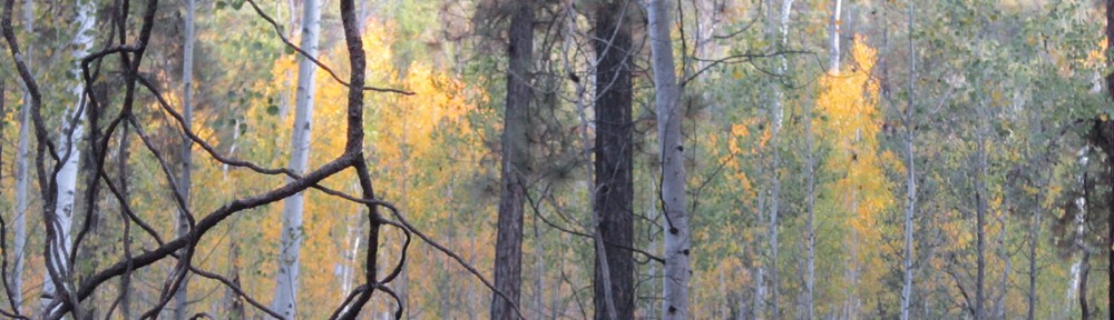
Finally, more than 200 acres are being treated using mechanical thinning, meaning heavy equipment, along Forest Road 122, also known as the Twin Springs Road, south of Bill Williams Mountain. This treatment is intended to serve as a buffer for any wildfires that might get started south of the mountain. This is a particularly important place to treat given prevailing winds in northern Arizona and the typical direction of wildfire spread due to those winds. This is also a critical treatment due to the high recreational use in this area and the resulting potential for unwanted, human-caused wildfires that could pose threats to the mountain and to the Williams community.

“For many years, even decades, on the Kaibab National Forest, we have been working toward this goal of treating Bill Williams Mountain in a truly significant way that will help not only in terms of forest health but also community protection and public safety,” said Mike Uebel, fuels program manager for the Williams Ranger District of the Kaibab National Forest and the implementation team leader for the Bill Williams Mountain Restoration Project. “To see all of the time, energy and preparation we’ve put into this effort turning into actual work on the ground is very rewarding and something we hope the Williams community will be pleased to see in action.”

Information sought in deer poaching case near Bagdad

KINGMAN – The Arizona Game and Fish Department (AZGFD) is seeking information about a recent poaching of a deer near Bagdad, Arizona.

The doe was shot in the neck on or about October 28 and left to waste near Hardy Schell, a stock tank northwest of Windy Ridge in Game Management Unit 18B. AZGFD is offering a reward of up to $1,000 for information leading to an arrest in this case.

“Evidence was collected at the scene, but help from the public will play a critical role in finding those responsible,” AZGFD Wildlife Manager AJ Lander said. “This is not the act of a hunter. Poaching is a crime. It is stealing wildlife from the citizens of Arizona. It is important for anyone with information to come forward and help Game and Fish bring those responsible to justice.”

An investigation is ongoing, and wildlife officers are seeking information about a 1980’s model two-tone blue and grey Ford Bronco. Two male individuals are believed to be involved.

One man was described as being in his 60s, with black curly hair and an overweight build. This individual was seen wearing black coveralls, similar to what a mechanic would wear, and is believed to be the driver of the Bronco. The other subject was also described as being in his 60s, with a slimmer build and was seen wearing blue jeans and an orange hunter hat.

Officers are asking anyone with information about the person or persons responsible for this crime to come forward.

Anyone with information about the case can call the department’s Operation Game Thief hotline toll-free at (800) 352-0700 and provide case number 17-004326 or use the online form at www.azgfd.gov/ogt. Callers’ identities will be kept confidential, and people can report anonymously if needed.

To learn more about Operation Game Thief, visit www.azgfd.gov/ogt.

Prescribed burning to continue near Tusayan

TUSAYAN – Crews plan to continue working on the Reed Prescribed Fire project east of Tusayan over the next few days and will likely begin on Friday of this week. Burning may continue into the week ahead providing weather conditions remain favorable for meeting forest health objectives and desired smoke dispersion.

Ignitions are set to continue on a 289 acre block approximately 4 miles east of Tusayan and just south of the East Rim Drive in the Grand Canyon National Park.

“The majority of smoke produced during daytime operations is expected to disperse away from sensitive areas, however we do expect some residual smoke to settle into drainages and low lying areas overnight.” said Quentin Johnson, Fire Management Officer on the Tusayan Ranger District. “Due to the proximity of these particular burn units located relatively close to town, our biggest challenge is trying to treat these acres with the least amount of smoke impact to the surrounding communities.”

Managers recognize the inconvenience smoke can cause and adjust tactics to limit the number of days smoke is in the air by burning smaller portions and only igniting every few days allowing ventilation to occur earlier and more rapidly. Among the many benefits of re-introducing fire to landscapes in these forested areas, broadcast burning is utilized to remove dead and down debris from ground surfaces over wide areas lessening the potential for a catastrophic wildfire.

Smoke may be visible from Highway 64 and from the communities of Grand Canyon, Valle and Tusayan. Overnight smoke impacts are expected to lift and ventilate rapidly each morning as ground surface temperatures warm in the morning hours.Officials remind motorists to always use caution when driving on roadways where visibility may potentially be impacted by smoke. Fire managers work closely with the Arizona Department of Environmental Quality, partners in the Grand Canyon National Park, as well as surrounding Native American tribes to monitor air quality.

For more information and the most current updates about prescribed fire on the Kaibab National Forest the following resources are available:

• Inciweb: inciweb.nwcg.gov/incident/5160/
• Fire Information Recorded Hotline: 928-635-8311
• Facebook: www.facebook.com/KaibabNF/
• Twitter: twitter.com/kaibabnf (Text ‘follow kaibabnf’ to 40404 to receive text messages.)
• Kaibab website “News & Events”: www.fs.usda.gov/kaibab

Game and Fish Commission to meet December 1-2 in Phoenix

PHOENIX – The next meeting of the Arizona Game and Fish Commission will be December 1-2, 2017, at the AZGFD headquarters at 5000 W. Carefree Highway in Phoenix. The public can attend in person, view the meeting on a webcast at https://livestream.com/azgameandfish, or (Friday only) watch the meeting on streaming video from any regional office statewide.

Those who wish to speak to the commission may submit “speaker cards” (blue cards) in person at the meeting or from any Game and Fish office (Friday only). The ability to speak to the commission is not available for those viewing the webcast.

The Friday, Deccember 1 portion of the meeting begins at 8 a.m. Among the items on Friday’s agenda are:

  • Consideration of a hunting and fishing license reciprocity memorandum of understanding with Nevada.
  • An update on state and federal legislation.
  • Consideration of a Notice of Final Expedited Rulemaking amending rules within Article 11 addressing aquatic invasive species.
  • Consideration of rulemaking recommendations for Article 3 regarding the taking and handling of wildlife.
  • Hearings on license revocations for violations of Game and Fish codes, and civil assessments for the illegal taking and/or possession of wildlife (time certain at 10 a.m.).
  • A briefing on recent bald eagle telemetry efforts to improve data gathering for management recommendations.
  • An update on department activities and involvement with resource management planning and other major actions on federal lands in Arizona.
  • Consideration of a new commercial public records request policy concerning the release of personal identifying information.
  • Request for acceptance of a perpetual access easement dedicated by the South Eastern Arizona Sportsmen Club to the department.

On Saturday, December 2, beginning at 8 a.m., the agenda includes:

  • Consideration of proposed Commission Orders 3 (pronghorn), 4 (elk) and 26 (population management) establishing seasons and season dates, bag and possession limits, permit numbers or authorized limits, and open areas for the 2018 and 2019 fall hunting seasons.
  • Consideration of the proposed hunt-permit tag application schedule for the antelope and elk 2018 hunts.

To view a copy of the full meeting agenda, visit www.azgfd.gov/commission and click on the “commission agenda” link.

The Arizona Game and Fish Commission is a five-member, policy-setting board that oversees the Arizona Game and Fish Department.

Work on Milton Road in Flagstaff to be rescheduled

FLAGSTAFF – Work that was scheduled to occur on northbound Milton Road this week and next between Phoenix Avenue and Mike’s Pike Street has been canceled because of weather-related concerns. Crews had been scheduled to replace a water line and construct new curbs, gutters and sidewalks on the east side of the roadway.

No dates for when the work will be rescheduled have been announced.

Reward offered in North Rim deer poaching

FLAGSTAFF – The Arizona Game and Fish Department is offering up to $8,000 reward for information leading to an arrest of yet another suspected poacher.

The latest case involves a mule deer buck that was found dead near Mount Logan on the North Rim of the Grand Canyon. The deer was recovered in game management unit 13A off County Road 5 and is suspected to have been killed sometime between November 17 and 19.

A lawful deer hunt started November 17 in unit 13A, but evidence at the scene suggests that the mule deer buck was possibly poached and edible portions of the animal were left to waste.

“This crime was obviously not the behavior of ethical, responsible hunters,” said AZGFD Wildlife Officer Luke Thompson. “We’re asking anyone who may have been in the area or has knowledge of the crime to come forward with information on this case. Poaching is a crime against all Arizonans and will not be tolerated. One tip could be all that’s needed to bring a poacher to justice.”

Anyone with information about the case can call the Department’s Operation Game Thief Hotline toll-free at (800) 352-0700 and provide case number 17-004571 or use the online form at www.azgfd.gov/ogt. Callers identities will be kept confidential and people can report anonymously if needed.

Fire managers to conduct prescribed fire southeast of Williams tomorrow

WILLIAMS – Fire managers for the South Zone of the Kaibab National Forest plan to treat up to 320 acres with prescribed fire tomorrow in the Sunflower Project area on the Williams Ranger District.

Specifically, fire managers plan to ignite the 320 acres in an area just south of Forest Road 139 and east of Hyde Hill about 8 miles southeast of the City of Williams. Ignitions should be complete by early afternoon, and fire managers do not anticipate conducting any other prescribed fires on the Williams Ranger District this week.

Smoke from tomorrow’s prescribed fire in the Sunflower Project area is expected to largely remain south of Williams and potentially impact Barney Flat and Cougar Park. It is possible that light smoke impacts may occur along County Road 73 and in Williams.

Prescribed fire projects require approval from the Arizona Department of Environmental Quality and are dependent on weather and wind conditions, so any project may be canceled if approval is not received or if conditions are not suitable. Members of the public can view approved prescribed fires for any given day on ADEQ’s website at http://www.azdeq.gov/environ/air/smoke/index.html. Prescribed fires on the Kaibab National Forest begin with the identifier “KNF.”

Fire plays a beneficial role in maintaining the ecological stability of many landscapes including the Kaibab National Forest. Managers use prescribed fire to reduce risks associated with uncharacteristic wildfires that can pose significant threats to public health and safety.

During prescribed fires, motorists are cautioned that smoke may be present for short durations, which may impact roads and populated areas. Motorists are reminded to use caution, drive slowly, turn on headlights, and avoid stopping in areas where fire personnel are working.

Notifications of upcoming prescribed fires are provided regularly by news releases throughout the season and also through the following resources:

Sign up to receive news releases from Kaibab NF: www.fs.fed.us/news/subscription.shtml (Choose “Southwestern Region.”)
Kaibab NF’s website: www.fs.usda.gov/kaibab (Look under “Recent News.”)
Kaibab NF’s Twitter account: www.twitter.com/KaibabNF (Text ‘follow kaibabnf’ to 40404 to receive text messages.)
Kaibab NF’s Facebook page: www.facebook.com/KaibabNF
Kaibab NF’s Inciweb page for the South Zone (Williams and Tusayan Ranger Districts): https://inciweb.nwcg.gov/incident/5160/#
Kaibab NF’s Inciweb page for the North Zone (North Kaibab Ranger District and North Rim of Grand Canyon National Park): https://inciweb.nwcg.gov/incident/5632/#
Kaibab NF’s Fire Information Recorded Hotline: 928-635-8311

A map of the Sunflower Project area is provided below. The map shows the entire 15,195-acre Sunflower Project. Tomorrow, fire managers plan to burn only 320 acres in the northeast corner of the larger project area just south of Forest Road 139 and east of Hyde Hill.

Governor’s Office of Highway Safety grant boosts ADOT crash-data gathering

PHOENIX – A grant from the Arizona Governor’s Office of Highway Safety is helping the Arizona Department of Transportation collect fuller and more accurate vehicle crash data that, in turn, will help transportation engineers, law enforcement and researchers examine trends and causes of fatalities and serious injuries.

The $389,520 grant provides critical financial support for ADOT’s Crash Records Unit, including annual licensing fees to use Traffic and Criminal Software (TraCS), a data collection and management tool. Through this grant money, ADOT provides access to TraCS to Arizona law enforcement agencies at no cost.

“TraCS is considered to be one of the best software platforms in the nation for managing electronic forms associated with traffic stops and crash reports,” ADOT Director John Halikowski said. “Support from the Governor’s Office of Highway Safety and Director Alberto Gutier is invaluable to collecting crash data and identifying trends, helping make Arizona’s roads safer.”

ADOT is responsible under state law for compiling crash data and creating comprehensive reports that government agencies, nonprofit groups and other entities statewide use to improve traffic safety. That includes annual Arizona Motor Vehicle Crash Facts reports.

The Arizona Governor’s Office of Highway Safety is the focal point for highway safety issues in Arizona. The cabinet agency provides leadership by developing, promoting and coordinating programs; influencing public and private policy; and increasing public awareness of highway safety.

For more information about the Governor’s Office of Highway Safety, please visit azgohs.gov.

For more information about ADOT, please visit azdot.gov.

Arizona launches Traffic Incident Management website for responders

PHOENIX – A new website will help make traffic incident response more efficient and vehicle travel safer for motorists in Arizona.

Created by the Arizona Department of Transportation and Arizona Department of Public Safety, the Arizona Traffic Incident Management website – tim.az.gov – debuts this week with the goal of being the go-to resource for Arizona TIM responder training.
TIM freeway

“Effective Traffic Incident Management keeps the public safe, emergency responders safe and traffic moving,” said Derek Arnson, ADOT’s Traffic Management Group manager. “It’s important that everyone who responds to a traffic incident, from law enforcement to tow truck operators, are working together and following the same practices.”

Traffic Incident Management (TIM) is the coordinated practices, responsibilities and cooperation of emergency responders, which includes law enforcement, fire departments, medical services, transportation crews and tow truck operators, at traffic incidents. These coordinated efforts help keep crash victims and emergency responders safe, while restoring traffic flow.

A primary focus in building the website was to create a central location for all of Arizona’s incident responders to sign up for and receive TIM training.

While the website is geared toward emergency responders, tips for the public can be found there, too, including videos and infographics related to Arizona’s “Move Over” law, “Quick Clearance” and work-zone safety.

A plank road was once the way between Yuma and San Diego

Arizonans think nothing of a quick weekend drive from Phoenix to San Diego’s beaches in about six hours. But a century ago, that trip could take the better part of two days across primitive roads and nearly impassable sand dunes.

Horses were more reliable for traversing sand dunes until enterprising road builders came up with a boardwalk for motorcars in 1915.

That’s right. Early adopters of horseless-carriage technology built a road of wooden planks across seven miles of sand west of Yuma in California. Arizona notably did not follow California down the path of building wooden roads.

The Plank Road and the Colorado River bridge at Yuma, completed in April 1915, were key steps forward for motorists traveling across the Southwest deserts in the early 20th century. Those advancements also were factors in competition between San Diego and Los Angeles to be the western terminus for a cross-country highway along a southern route.

The Colorado River State Historic Park in Yuma has a Plank Road display with a Model T automobile. There’s also a preserved section of the Plank Road at the Bureau of Land Management’s Imperial Sand Dunes Recreation Area south of Interstate 8 on the Gray’s Well Road about 12 miles west of Yuma. That’s where this Bureau of Land Management photo was taken.

Plank Road skeptics like civil engineer Joseph Lippincott, an Auto Club of Southern California consultant, pegged the wooden highway as “the most asinine thing he had ever heard of,” according to a San Diego Tribune report at the time.

But the road, despite its flaws, carried traffic for more than a decade until it was replaced in 1926 by an asphalt road that became US 80 and more recently Interstate 8.

One Yuma merchant praised the Plank Road. “It is no ride across the Sahara Desert, but rather a pleasure trip anyone can enjoy,” the man said, according to B. Johnny Rube in his 1996 book A Wooden Road Through the Hollow of God’s Hand.

Initially, the Plank Road was boards laid in parallel tracks to provide a path for adventurous drivers. In 1915, the California Highway Commission took over the Plank Road, installing 12-foot by 8-foot wooden sections on the dunes west of Yuma.

The knock on the one-lane Plank Road was that it forced drivers traveling in opposite directions to use pullouts every 1,000 feet to pass each other. Maintenance was a constant problem as horse-drawn scrapers were used to clear the sand, which damaged the planks and made for a rough ride. Sand drifted across the planks and drivers would “lose” the road and end up stuck in the sand. That created commerce for the Fort Yuma Quechan Indians whose horses served as the tow trucks of the era, pulling cars out of the sand and back onto the Plank Road, said Tina Clark, historian of the Yuma Crossing National Heritage Area.

The Plank Road was an extension of previous methods early motorists used to get through sand dunes and other difficult terrain.

In 1910, the National Highway Association employed a pathfinder named A.L. Westgard to explore cross-country routes from Washington, D.C., to Los Angeles. He’s been described as the “Marco Polo of the Motor Age.”

While scouting a route called the Trail to Sunset , Westgard used rolls of canvas on the sand to get across the Yuma dunes. He later carried wooden planks on his vehicle to get across sand or mud flats, according Arizona Highways, published by the Arizona Department of Transportation.